
Autel Robotics Dragonfish Drone
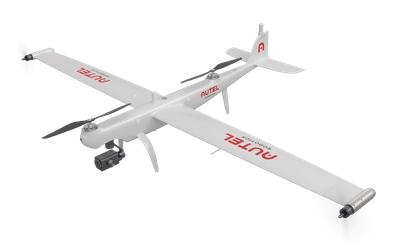
Autel Robotics Dragonfish
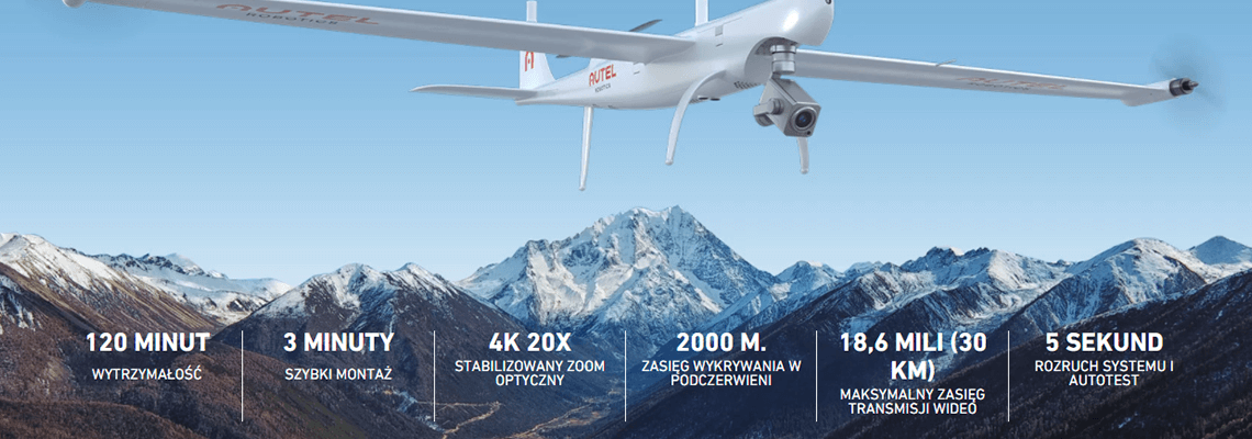
The Dragonfish's unique convertible design simplifies operation and maximizes productivity and efficiency. With no complicated moving parts, Dragonfish is modular, waterproof, smart and reliable. Dragonfish is mission-ready right out of the box and includes powerful AI tracking capabilities and multiple modular payload options. The flight time of 120 minutes (including payload) further extends the amazing capabilities of the Dragonfish mission and pushes it significantly ahead compared to other competing VTOLs.
INTELLIGENCE AND AUTONOMY
Dragonfish is equipped with many automated features to streamline and simplify mission tasks. Advanced algorithms provide an extra layer of consistency and simplicity for the user experience.
 | One touch landing |
Fast AI tracking | 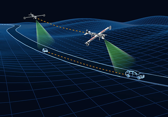 |
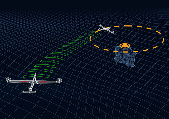 | Point of interest |
Intelligent Adaptive Tracking |  |
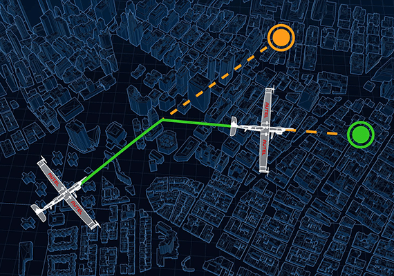 | Advanced mission planning |
REMOVABLE CAMERA SYSTEM
Dragonfish allows you to mount different cameras depending on which solution you need. The mounting system is quick and simple to instantly adapt to mission needs.
Dual 4K Camera
- Stabilized 4K 20x optical zoom
- 48MP wide-angle camera
- 3-axis gimbal
Triple camera with thermal imaging function
- Stabilized 4K 20x optical zoom
- 48MP wide-angle camera
- Thermal imaging camera 640x521
- 3-axis gimbal
Multispectral
- Wide Angle RGB Camera (48MP)
- 5 multispectral sensors (2MP)
RTK MODULE
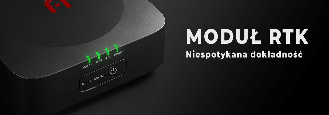
Dragonfish is equipped with 2 RTK modules for additional redundancy. Thanks to the integration of the GNSS base station with RTK modules, Dragonfish can achieve accuracy up to a few centimeters. Dragonfish are precise courses while maintaining anti-magnetic properties. These modules back up each other and significantly improve the quality of image metadata for photogrammetry and increase flight precision and safety.
PROFESSIONAL SOFTWARE SOLUTIONS
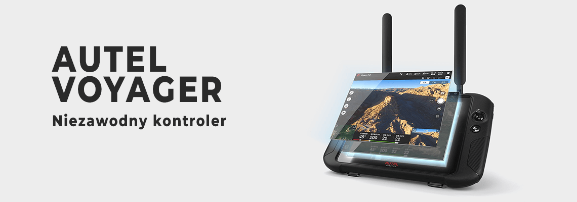
Autel Voyager
Autel Voyager is specially designed for the Dragonfish drone, for industry applications. The software provides advanced mission planning, intelligent tracking, flight history tracking and other autonomous features. Easy to use, yet incredibly functional. Autel Voyager is a comprehensive solution for every task.
9.7 inch ultra bright 1000NIT ground control panel
High resolution (2048*1536), 9.7 inch ultra bright (1000 nits) TFT-LCD touch screen for maximum visibility and practicality in any situation.
Autel apparatus is water, dust and water resistant. New Autel Robotics antenna design allows video transmission up to 18.6 miles (30 km)
. The Autel Robotics controller has a battery life of up to 4.5 hours and can be operated indefinitely using a remote power source.
COMPACT AND PORTABLE
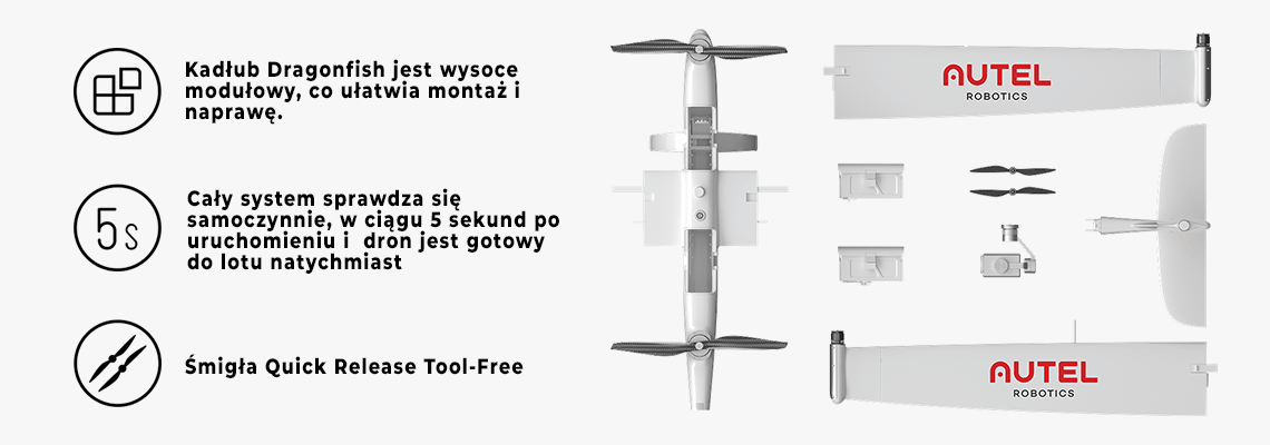
The Dragonfish can be easily disassembled by one person and will fit in the back of a typical car boot. The entire system can be assembled without any tools and is ready to fly in less than 5 minutes.

We present a video in which you can see the amazing capabilities of this drone:
Specification:
Autel Robotics Dragonfish Drone
| Dimensions | 2.3*1.29*0.46m (L*W*H) |
| Libra | 7 kg (including two batteries, without gimbal) |
| Single battery weight | 1.3 kg |
| maximum load | 1.5 kg |
| Maximum take-off weight | 8.5 kg |
| working frequency | 902-928MHz,2.4000-2.4835GHz,5.725-5.755GHz |
| EIRP (equivalent radiated power) | 900MHz FCC:<30dBm; 2.4GHz FCC:<30dBm SRRC/CE/MIC:<20dBm; 5.8GHz SRRC/FCC:<30dBm CE: <14 dBm |
| Hover accuracy (P-mode with GPS) | Perpendicularly: ± 0.1 m (vision system on) ±0.5m (GPS on) ±0.1m (RTK on) Horizontal: ± 0.3 m (vision system on) ± 1.5m (GPS on) ±0.1m (RTK on) |
| RTK positioning accuracy | When RTK is on and steady: 1 cm + 1 ppm (horizontal) 1.5cm + 1ppm (vertical) |
| Maximum angular speed | Pitch: 180°/s, Yaw: 60°/sec |
| Maximum angle of inclination | 20° |
| Maximum tilt angle | 35° |
| Maximum ascent rate | Vertical flight mode: 4m/s Fixed wing mode: 5m/s |
| Maximum descent speed (vertical) | Vertical flight mode: 3m/s Fixed wing mode: 5m/s |
| Max speed | 30 m/s |
| Service ceiling above sea level | 6000 m |
| Maximum flight time | 120 minutes |
| Loads handled | Two-sensor payloads, three-sensor, multispectral, third-party payloads |
| Supported gimbal configurations | Quick disassembly |
| Degree of protection against ingress | IP45 |
| GNSS | GPS + GLONASS + BeiDou + Galileo |
| operating temperature | -20°C to 50°C (-4°F to 122°F) |
9.7 inch ground control station (video transmission):
| working frequency | 902-928MHz;2.4-2.4835GHz |
| Maximum transmission distance (unobstructed, no interference) | FCC:10km CE/MIC:5km SRRC:5km |
9.7 inch ground control station (data transmission):
| working frequency | 5.725–5.755 GHz |
9.7 inch Ground Control Station (WiFi):
| Protocol | Wi-Fi Direct; Wireless; Show; 802.11a/g/n/ac; WiFi with 2×2 MIMO |
| working frequency | 2.400 - 2.4835 GHz 5.150 - 5.250GHz 5.650 - 5.755GHz 5.725 - 5.850 GHz |
9.7 inch Ground Control Station (General):
| Battery | Type: Li-Po Capacity: 8200mAh Voltage: 52.8V Energy: 93Wh Charging time: 120 minutes |
| Action time | 3 hours (maximum brightness) 4.5 hours (half brightness) |
| Capacity | ROM 16GB + Scalable (TF) |
| video output | HDMI port |
| Supply current / voltage (USB-A port) | 5V/500mA |
| Operating temperature range | -4° to 104°F (-20° to 40°C) |
| Storage temperature range | <1 month: -20° to 60°C (-4° to 140°F) 1-3 months: -20° to 45°C (-4° to 113°F) 3-12 months: -4° to 86°F (-20° to 30°C) |
| Charging temperature range | 32° to 113°F (-0° to 45°C) |
| GNSS | GPS + GLONASS + Galileo |
| Dimensions | 319*233*74mm(antennas folded) 319*398*74mm(antennas unfolded) |
| Libra | 1987g |
Base station (GNSS receiver):
| Satellite reception frequency | Simultaneous reception: GPS: L1, L2, L5 BeiDou: B1, B2, B3 GLONASS: F1, F2 Galileo: E1, E5A, E5B |
| Positioning accuracy | single point Horizontal: 1.5m (RMS) Vertical: 3.0m (RMS) RTK Horizontal: 1 cm + 1 ppm (RMS) Vertical: 1.5 cm + 1 ppm (RMS) 1 ppm: For 1 km increase in distance, the accuracy will be 1 mm less. For example, the horizontal accuracy is 1.1 cm when the receiving end is 1 km from the base station. |
| Positioning update rate | 1Hz, 2Hz, 5Hz, 10Hz and 20Hz |
| Cold start | <40s |
| A warm start | <10 sec |
| Retrieve | <1s |
| Initialization reliability | > 99.9% |
| Differential data transmission format | RTCM 2.X / 3.X |
Base station (communication):
| Data links | Image transmission, Wi-Fi |
Base station (image transmission):
| working frequency | 902-928MHz; 2.400-2.4835GHz; |
| EIRP (equivalent radiated power) | 902-928MHz FCC: <30dBm 2.400-2.4835GHz FCC: <30dBm SRRC/CE/MIC: <20dBm |
Base station (Wi-Fi):
| working frequency | 2.400-2.4835GHz; 5.125-5.25GHz; 5.650-5.755GHz; 5.725-5.850GHz |
| EIRP (equivalent radiated power) | 2.400-2.4835GHz FCC: <26dBm SRRC/CE/MIC: <20dBm 5.125-5.25GHz FCC/SRRC: <26dBm 5.650-5.755GHz MIC: <20dBm 5.725-5.850GHz SRRC/FCC: <26dBm CE : <14 dBm SRRC/CE/MIC: <20dBm |
| communication distance | Mobile station and aircraft: 30 km (FCC) Mobile station and remote control: 200 m (FCC) (unobstructed and no interference when the mobile station is used as a base station), and the distance from the mobile station antenna to the bottom of the tripod is 2m; and when the height difference between the remote control and the mobile station is less than 10 m and when the remote control is 1.2 m from the ground level) |
Base station (electrical characteristics):
| Energy consumption | 7.5W |
| Charger | 5 to 20 V DC (supports USB PD charging protocol) |
| Battery | Type: lithium polymer battery Capacity: 4950mAh Energy: 57.1WH |
| Action time | > 7.5 hours |
Base station (physical properties):
| Size (base station body + extension rod) | 193mm × 177mm × 73mm |
| Libra | 1275 g |
| Dustproof and waterproof | IP65 |
| working temperature | -20°C to 50°C |


 Drone service
 Helpful
 Reliability
 Trust
Trust Own warehouse
  Warranty