Lidar - what is it in the drone world?
Lidar technology plays increasingly important role in drones. It is a precise measurement method that was originally developed for aviation and is now used m.in. in engineering, agriculture or even archaeology. Such solutions can also be encountered in the offers of the most well-known manufacturers, such as DJI.
Lidar - what it is and how it works?
The name "lidar" comes from the full name of this technology in English - Light Detection and Ranging, which can be translated as detection and measurement with (laser) light. We may also encounter the notation "LIDAR" or "LiDAR". What it is and how it works? The basic mechanism here is use of laser pulses to measure the distance between the camera and the object. The lidar sensor emits hundreds of thousands of pulses per second, which then bounce off the surface and return to the receiver. Such a high frequency makes the measurement characterized by a very high level of precision.
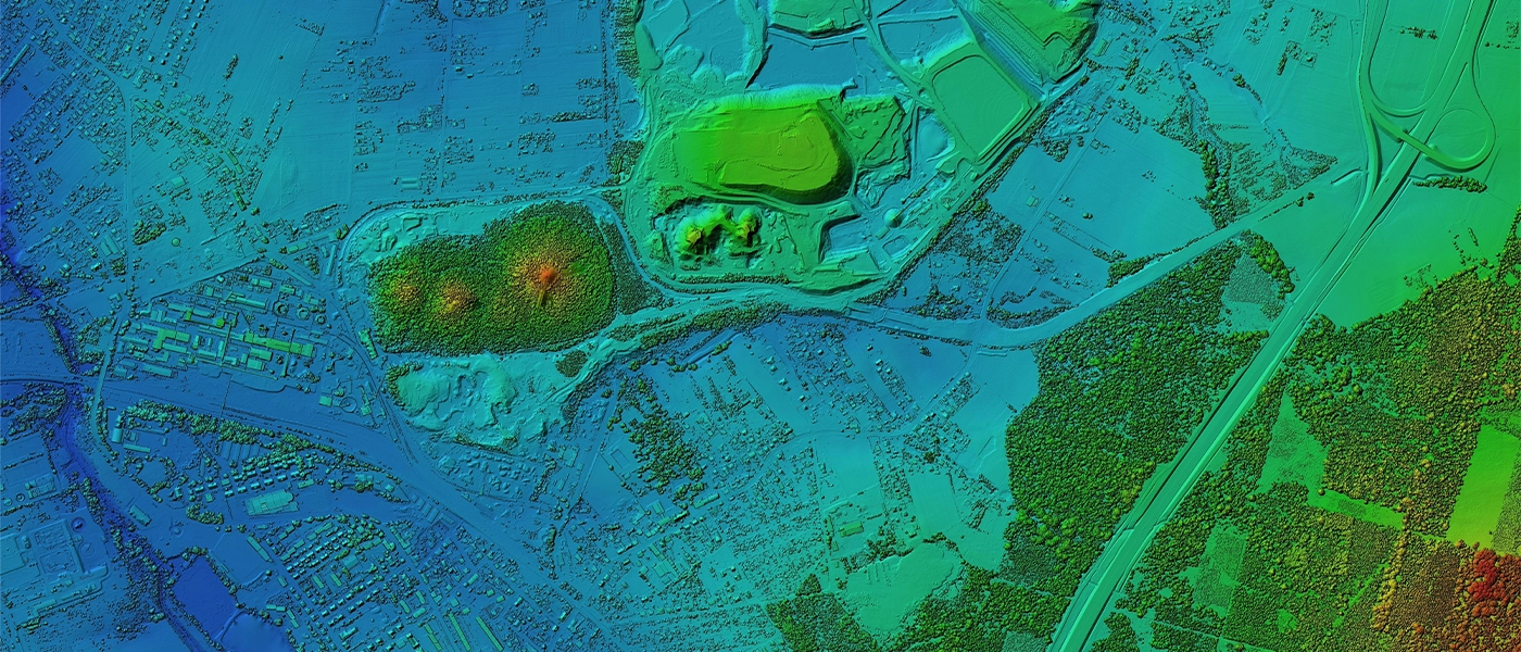
The time it takes for the pulse to return is continuously measured by the lidar scanner. What it means? Such functionality allows, first of all, to accurate determination of distance and creation of a three-dimensional image of the scanned surface. In the case of drones, lidar can, for example, analyze terrain from the air, providing detailed data on landforms, vegetation or buildings.
Lidar scanner - where it is used?
The applications of this technology are wide-ranging and include many different industries. Using the lidar scanner in drones, you can m.in. produce detailed maps topographical for geodesy and cartography. Information collected by sensors is an invaluable support for infrastructure planning or analyzing environmental changes. An important area of lidar use is also agriculture, where such solutions are used, for example, to monitor crops and manage water resources. Also, archaeologists can use this technology to uncover structures hidden underground without the need for invasive excavation work. Lidar in drones is also used in forest monitoring, avalanche risk assessment and atmospheric research.
DJI Lidar - advanced technologies in drones
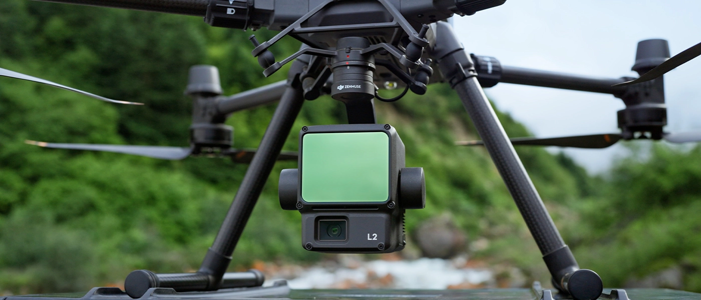
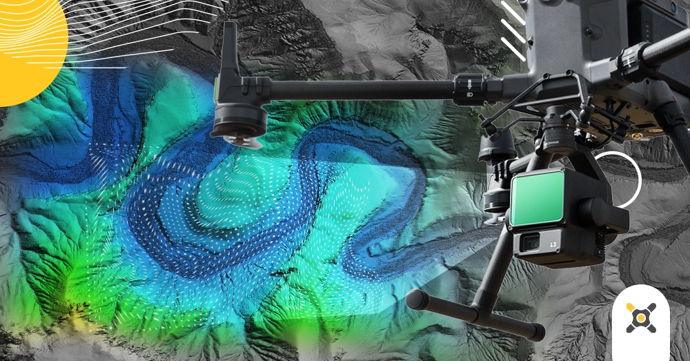
One of the manufacturers that use lidar scanners in their devices is the brand DJI - the world market leader in commercial and specialized drones. Worth noting in particular DJI Zenmuse L2 camera for advanced aerial measurements, which integrates a frame-based lidar scanner, a proprietary high accuracy IMU system and a CMOS RGB mapping camera. Thanks to DJI Zenmuse L2 aerial platforms DJI can accurately, efficiently and reliably acquire geospatial data. In addition, the entire system is compatible with DJI Terra software, which allows for convenient storage and processing of 3D data.
Innovative camera DJI Zenmuse L2 with lidar system offers a range of new opportunities in various industries. The application of this solution includes m.in. surveying, urban planning, energy resource management, construction, energy and public safety. Compared to the previous L1 model, the new version provides even more accurate digital elevation models and more precise scanning of objects over a large area. Not insignificant are also parameters DJI Zenmuse L2:
- the ability to take measurements up to up to 450 m at 50% reflectance and 0 brightness;
- optimum operating altitude up to 120 m;
- reduced laser spot size that allows detection of smaller objects with more detail;
- ability to capture up to five beam reflections even in areas densely covered with vegetation;
- effective sampling range up to 240,000 points per second.
With such impressive specifications, DJI Zenmuse L2 can provide extremely valuable support in a variety of areas. The lidar offered by DJI has the potential to greatly expand and improve the quality of aerial surveying, which also involves more efficient management of the environment, resources and infrastructure. It is also an opportunity to wsupport rescue, research and education activities.
Types of lidar systems
Depending on the device, different types of lidar systems are available to suit specific needs and applications. Primarily two main types can be distinguished, which differ in terms of the area of operation.
- Terrestrial Laser Scanning (TLS) - They are often stationary systems used for ground measurements. Such solutions are used primarily in construction and surveying, and have the advantage of high precision measurements over small areas.
- Airborne Lidar (ALS - Airborne Laser Scanning) - lidar scanner installed aboard aircraft, including drones. Their primary task is to collect data on the scanned landscape with the creation of 3D models. These types of systems allow to measure a larger area. In addition, they can be divided into two more types: topographic lidar (for land surveys) and bathymetric lidar (for water body surveys).
Creating precise maps using lidar
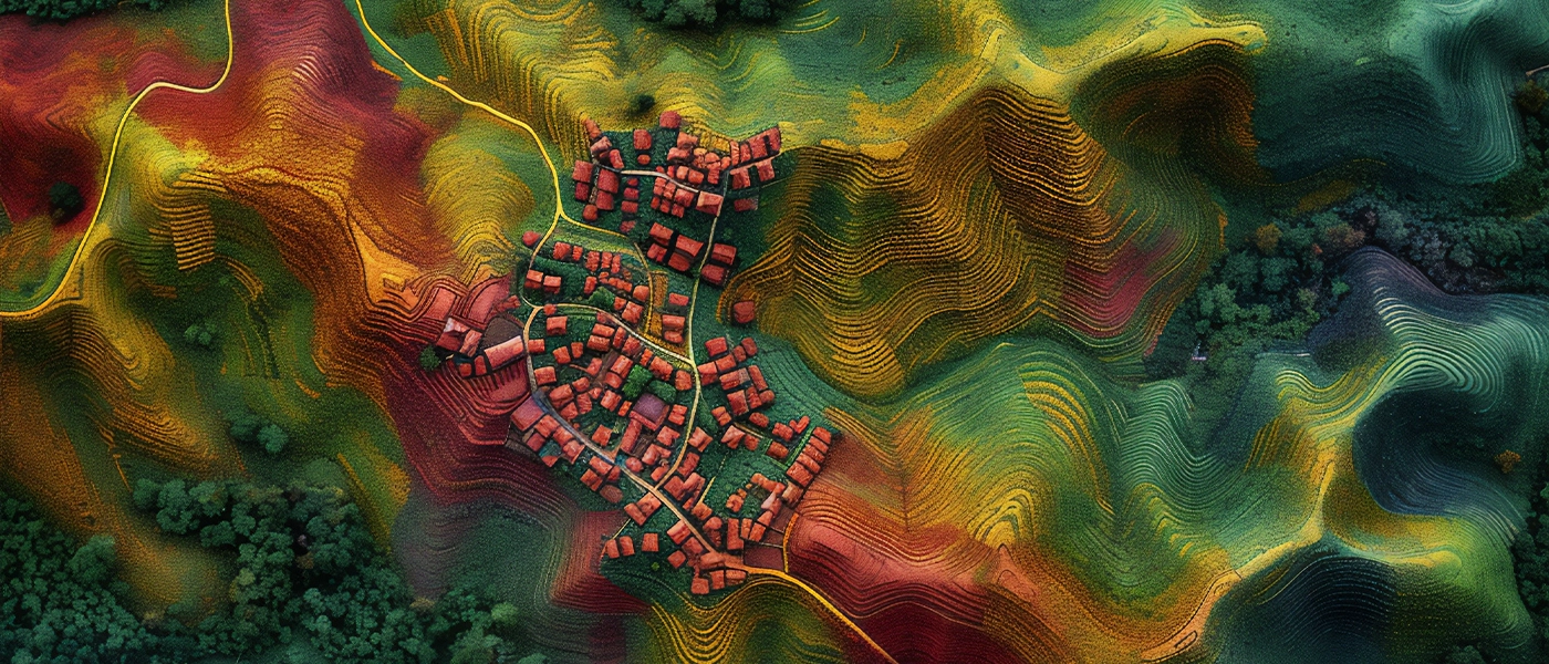
What else lidar technology can be used for? A map made with a scanner is one of the most important applications of this solution. Precise data obtained by the laser sensor is processed and analyzed to create detailed 3D models of the terrain. Such maps are extremely valuable in urban planning, natural resource management, as well as in emergency situations, such as natural disaster management. The precision of lidars makes them indispensable in places where traditional survey methods are insufficient or too time-consuming.
The broad applicability of lidar technology makes it one of the most important solutions in the aerial survey space today. It is worth bearing in mind that the scanners can also be used with drones - its proposals in this area are offered by m.in. DJI, having in its offer solutions such as specialized camera DJI Zenmuse L2.