Drones with thermal imaging camera vs. photovoltaics - aerial support for RES
2020-03-24

Since last year, the photovoltaic industry has been booming and is the most rapidly growing branch of the Renewable Energy Resources (RES) segment. Drones with thermal imaging cameras, which, thanks to their built-in sensors and algorithms, make it possible to improve the quality of inspections of photovoltaic installations and reduce measurement time, have certainly contributed to this success.
Drones with thermal imaging camera - diagnostics of photovoltaic installations
There is no denying that taking advantage of the opportunities provided by drones is a time and human resource saver. We have already mentioned their professional use here and here. In addition to saving money, it is also important to increase the safety of working conditions (here we refer you to read the last article).
PV industry benefits from using drones with thermal imaging in each of these fields.

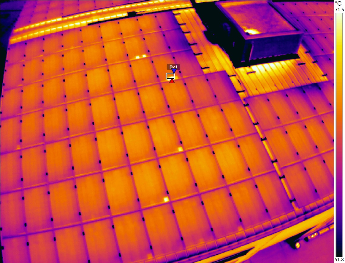
Photovoltaic panels recorded with a thermal imaging camera.
Security
In the case of inspection of photovoltaic panels, safety plays a special role given the need to work at height for those performing diagnostics on the installation and the risks associated with ignition of the module.
A drone with thermal imaging can measure the temperature distribution of the cells from a safe distance and detect the so-called hot spot, i.e. a damaged component whose temperature is significantly elevated.

Hot spots recorded by drone. Source: Pix4D
Moreover, any work in the field involves an increased risk of. Reducing the inspection of a given installation and reducing the number of workers involved in it reduces the number of accidents and breakdowns.

3d model of materials collected during drone inspection. Source: Pix4D
Saving time and resources
Commercially available drones with thermal imaging cameras have ranges as short as 1.6 km (Yunnec Typhoon H520 with CGO-ET camera) to as much as 5 km (DJI Mavic 2 Enterprise DUAL Flir or Matrice 200 V2 on camera Zenmuse XT2), so they are able to move between segments even on extensive photovoltaic farms. Without the help of a drone, inspecting such an area would require the work of several people for at least several weeks.
Typical photovoltaic farm diagnostics involve time-consuming rounds of service technicians with a thermal imaging camera. Intelligent flight functions, flight along a designated route make thermal imaging drones an autonomous work tool.
Drone in the photovoltaic industry - vision support
Drones in the photovoltaic industry are used not only for thermal measurements. Drones with a thermal imaging camera, such as Parrot Anafi Thermal or Mavic 2 Enterprise Dual Flir, are equipped with high-quality RGB cameras manufactured by Sony. They can make professional visual imaging materials, making it easier to plan and control plant maintenance activities. Detailed photos and footage allow verification of repair work, as well as the overall condition of the infrastructure.
Drones for photovoltaics - 3D modeling
The ideology of RES, including photovoltaics, is based on protecting the environment and interfering with it as little as possible. Drones are used to optimize photovoltaic investment projects to make their location and structure as efficient as possible.
The use of drones for 3D models allows for accurate mapping of the terrain and the best possible depiction of the location where the photovoltaic installation is to be built.
Here, not only professional drones with thermal imaging cameras will work, but also drones of the type DJI Mavic Air or Mavic Pro Platinum.
Equipped with sensors and a high-resolution camera, the machines will verify with high accuracy the optimal sunlight for mounting photovoltaic panels.
This allows for economical layout of modules, faster installation, and thus reduced costs for the entire project.
One of the programs dedicated to creating 3D models is Pix4D, which also allows the creation of complex presentations. The program is compatible, min. with the aforementioned Anafi Thermal or DJI Mavic 2 Pro.
You can find the full list of compatible drones here here.

Create a project using measurements taken from a drone.
Proper placement of panels also affects the ability to pack them more densely in photovoltaic farms, reducing their surface area, so the environmental impact.
Drone conversion powers also take into account factors that a human engineer might overlook, such as the location of transmission lines or the angle of the shadow produced by panels that follow the sun's rays.
Drones in the Renewable Energy Resources industry - another application
In addition to the photovoltaic industry, we are seeing increasing interest from companies involved in other renewable energy resources as well. In addition to site inventories for investment planning, the drones perform inspections of power grids and examine the structural condition of all kinds of installations.
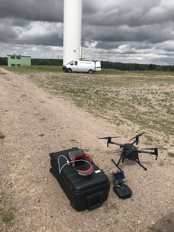
For our location - the areas of Pomeranian Voivodeship - a characteristic form of RES are wind power plants, at which it is increasingly common to audit turbines with the help of drones. For this task, the Matrice 200 V2 with the XT2 thermal camera and with the help of FPV goggles works great DJI Goggles RE, what we had the opportunity to test ourselves.

Show more entries from
March 2020