


 Drone service
 Rental
 Reliability
 Trust
Trust Own warehouse
  Warranty
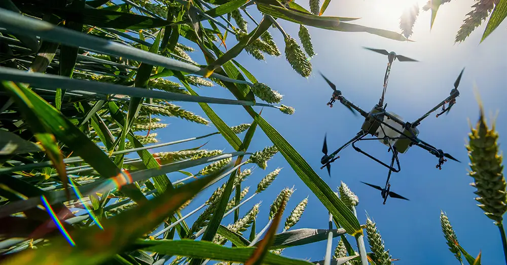
Megadron Blog
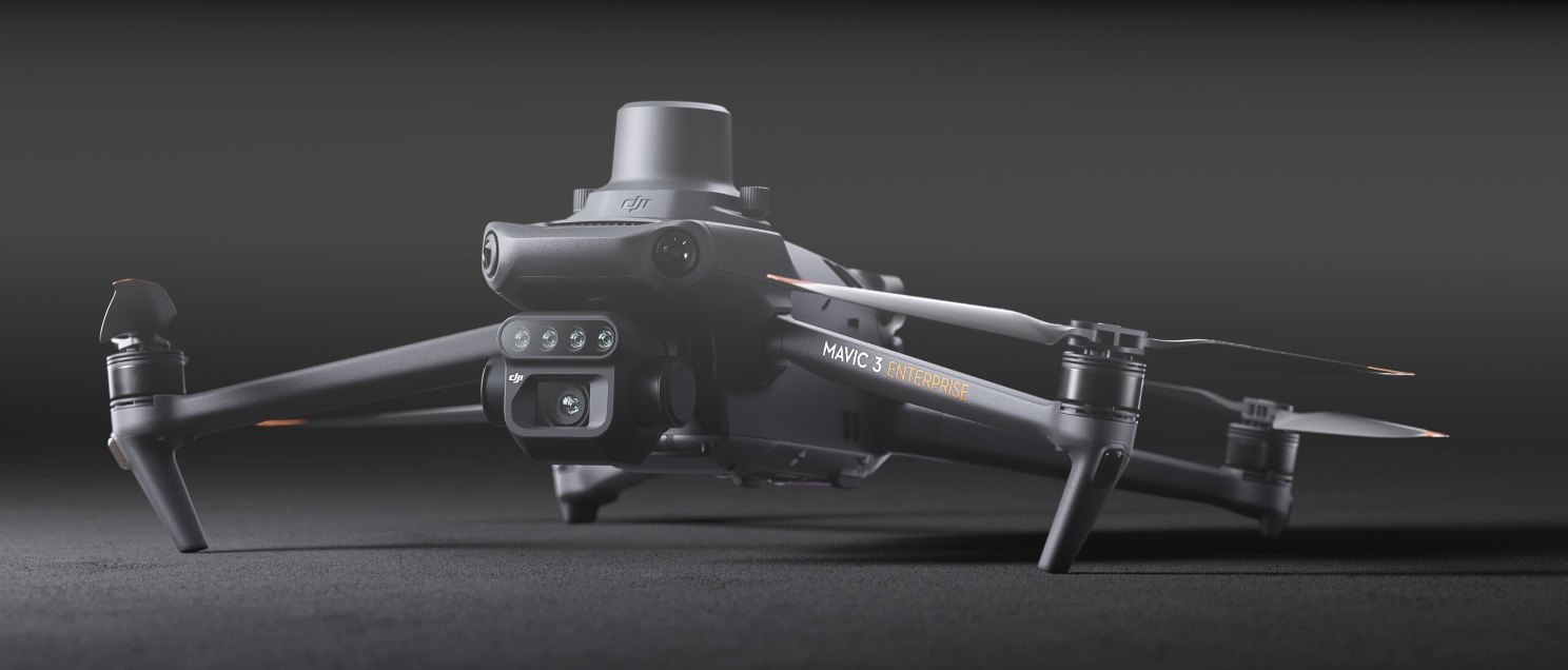
In this article, we compare three models of DJI Mavic 3 series drones: the Mavic 3 Enterprise, Mavic 3 Thermal and Mavic 3 Multispectral. We present their features, functions and fields in which they can be used.


Mavic 3 Multispectral sees in two ways. It combines an RGB camera with a multispectral camera for scanning and analyzing crop growth. Managing the entire agricultural production process requires high precision and data. This device provides both.
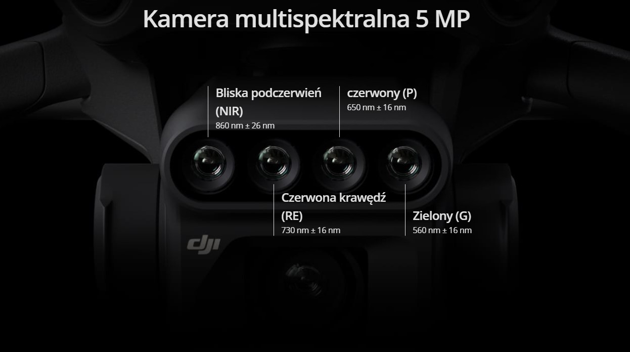
Compact and portable Foldable for easy storage | Multispectral camera 4x 5MP (GRAM/R/RE/NIR) | RGB camera 20MP 4/3" CMOS with mechanical shutter |
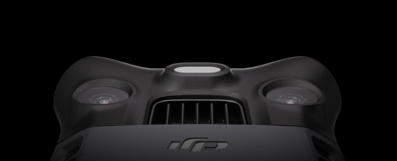
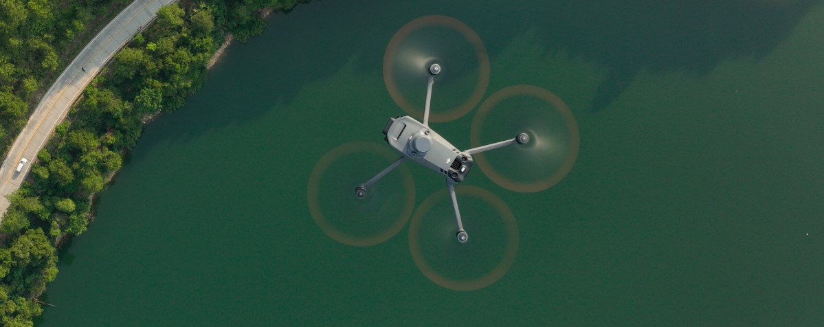
Safe and stable Omni-directional obstacle avoidance. Image transmission distance up to 8km | Precise positioning RTK positioning at the centimeter level. Time synchronization at the microsecond level | Efficient aerial measurements up to 200 hectares per flight |
The newly upgraded imaging system features one 20MP RGB camera and as many as four 5MP multispectral cameras (green, red, red edge and near-infrared) . It enables applications such as precision aerial surveying, crop growth monitoring and natural resource research.
The built-in sunlight sensor records solar radiation intensity and stores it in the image file, allowing light compensation of image data during 2D reconstruction. This results in more accurate NDVI results, as well as improved accuracy and consistency of the data obtained over time.
Mavic 3M with RTK module for centimeter-level positioning. The flight controls, camera and RTK module synchronize within microseconds to accurately capture the location of each camera's imaging center. This allows the Mavic 3M to perform highly precise aerial measurements without using ground control points.
The battery lasts for a flight of up to 43 minutes . This means that a maximum of 200 hectares of land can be mapped in one flight .
O3 transmission integrates two transmitting signals and four receiving signals to support ultra-long transmission distances.
The drone is equipped with multiple wide FOV vision sensors that accurately detect obstacles in all directions, enabling obstacle avoidance in all directions. Aerial field measurements can be easily performed on steep slopes.
Mavic 3M enables bird's eye view of the terrain in orchards, even on sloping terrain. Together with DJI Terra or DJI SmartFarm Platform, it can perform high-resolution reconstructions of an orchard, automatically identify the number of trees, distinguish trees from other obstacles or objects, and generate three-dimensional operational routes for agricultural drones, making operations safer and more efficient.
Mavic 3M is used to obtain multispectral images of crops. DJI Terra or DJI SmartFarm Platform can then generate NDVI maps and other vegetation indices, capturing differences in crop potential and generating recommendation maps that enable agricultural drones to perform variable rate applications. This ultimately allows users to reduce costs, increase efficiency and protect the environment.
Mavic 3M can perform automatic terrain reconnaissance. Field images can be transmitted to the DJI SmartFarm platform in real time via 4G. It can detect abnormalities such as poor emergence, weed pressure and crop lodging in a timely manner. It can also perform intelligent analysis such as cotton seedling identification and rice production testing, using AI identification to share real-time crop growth information, guide agronomic activities, and easily manage 70 hectares of agricultural land by one person .
The Mavic 3M can also be used in environmental and natural resource research, such as water enrichment monitoring, forest distribution surveys, urban green space surveys, and more.
The Mavic 3M can be directly connected to a third-party cloud platform via the Remote Control 2's built-in MQTT-based DJI Cloud API . There is no need to create a separate application to enable the transmission of UAV equipment information, live broadcast, photo data and other information.
Mavic 3M supports Mobile SDK 5 (MSDK5) with a fully open-source production code sample. MSDK5 enables the development of a proprietary control application for UAV field patrols, smart surveying and other scenarios, making it more user-friendly.
Set includes:
| Net weight (with propellers and RTK module) | 951 gram |
|---|---|
| Maximum takeoff weight | 1050 gram |
| Dimensions | After folding (without propellers): 223×96.3×122.2 mm (length × width × height) Unfolded (without propellers): 347.5×283×139.6 mm (length × width × height) |
| Diagonal | 380.1mm |
| Maximum rate of climb | 6 m/s (Normal Mode) 8 m/s (Sport Mode) |
| Maximum descent speed | 6 m/s (S Mode) 6 m/s (N Mode) |
| Max. flight speed (no wind) | 15 m/s (N Mode) Forward: 21 m/s, Sideways: 20 m/s, Reverse: 19 m/s (S Mode) [2] |
| Max wind speed resistance | 12 m/s |
| Maximum take-off altitude above sea level | 6000 m (without live load) |
| Max flight time (no wind) | up to 43 min |
| Max. hovering time (no wind) | up to 38 min |
| Maximum flight distance | up to 8 km (CE) |
| Maximum tilt angle | 30° (N Mode) 35° (S Mode) |
| Maximum angular velocity | 200°/sec |
| GNSS | GPS + Galileo + BeiDou + GLONASS (GLONASS is only supported when RTK module is enabled) |
| Hover accuracy | Vertical: ±0.1 m (with vision system); ±0.5 m (with GNSS); ±0.1 m (with RTK) Horizontal: ±0.3 m (with vision system); ±0.5 m (with high precision positioning system); ±0.1 m (with RTK) |
| Operating temperature range | -10° to 40° C |
| Internal storage | Lack |
| Engine model | 2008 |
| Propeller model | 9453F - Enterprise |
| Light sensor | Built into the drone |
 Get expert advice