Where to fly a drone? Map of geographical zones

Flying a drone, in addition to being used for professional materials, is also excellent fun, but it involves the need to observing certain rules. In a world where drones share space with airplanes, helicopters and other machines in the air, there is an urgent need to be aware of where you can fly safely.
As a drone operator, one of your first steps before every flight should be to find out exactly where you can and cannot use your drone. The essence of this is to understand the geographical zones before deciding to take off. Remember that flying a drone should provide joy and satisfaction while not creating danger or trouble, such as violating unauthorized flight space. Such actions can result in serious financial consequences or even accidents, so knowledge of geographic zones is crucial for safe and responsible use from drones.
Geographic zones - what they are and what they mean?
In recent years, with the rapid development in the world of drones, new regulations have been introduced for the use of airspace. Geographic zones have become a very important element of security, privacy and environmental protection in the context of drone operations.
According to Executive Regulation (EU) 2019/947/EU, a geographic zone is a part of the airspace designated by the competent authority to manage drone operations. In Poland, it Polish Air Navigation Services Agency (PAŻP) is responsible for designating these zones.
Drone flying zones are divided into those where you can fly without permission from the zone manager, those where flying is not allowed, and those that are more complicated. These include zones where the operation can be performed, but with the approval and under the conditions specified. There are also zones where you can perform the operation, following the specific information necessary in the zone. In addition, you can hit zones that require either specific technical requirements or verified services.
You will learn more about the zones in a later section of this article.
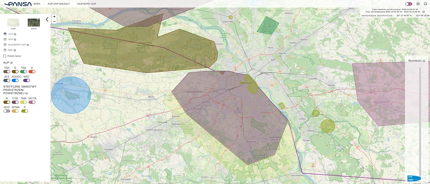
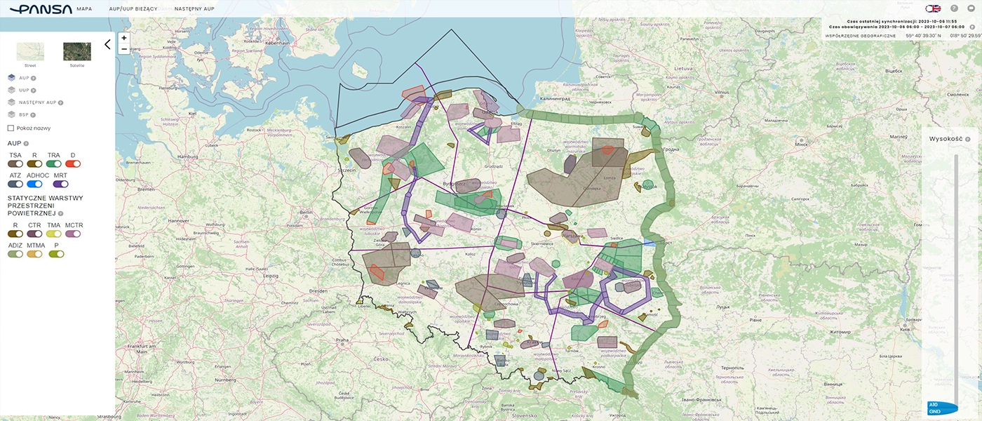
Awareness and adherence to closed airspace (prohibited zones), areas where you can't fly a drone, becomes a key issue. These areas have been designated by competent authorities to eliminate potential security, privacy, data protection and environmental risks. You should actively use the available tools, such as check-In application or DroneMap, to check the current availability information in the area before each flight, thus ensuring safe drone use in the airspace. In these applications, if you put a pin where you want to fly, you will be shown information about the zone that applies and the requirements for it.

Types of geographical zones
We distinguish 5 types of geographical zones DRA (DRone Airspace). Each is divided into airspace zones:
1. DRA-P is a prohibited area where drone operations are strictly prohibited, with certain exceptions that can be obtained under conditions set by the PAŻP. It also includes airspace zones:
- TSA (Temporary Segregated Area) - A temporarily restricted area, usually designated as an operational area near a military airport. In this area there is an unconditional ban on flights.
- MRT (Military Route) - military aviation routes with a specific shape, which may include a ceiling from 0 ft, which involves a general prohibition of use during activity in the zone.
- TMA (Terminal Manuvering Area) - civil airport control area at higher altitudes (above 1000 ft), covering the area around the airport. Unconditional ban on drone use in the area.
- MTMA (Military Terminal Manuvering Area) - applies to the area around military airfields, including at higher altitudes, usually above 1,000 feet. There is a total ban on drone flights.
- TFR (T Feeding Routes)-military thoroughfares are sparsely populated areas located at a significant ceiling.
- R (Restricted) - areas established without prior notice, for example, during rescue operations, accidents or special events. The person authorized to establish such an area may issue permission to use a drone in the area, but flying is otherwise prohibited.
2. DRA-R is a restricted area in which drone operations may take place with the permission and under the conditions set by the PAŻP or an authorized entity that has applied for the designation of a geographic zone.
- MCTR (Military Control Zone) - an area controlled by a military airport, where regulations are set by the Chief of the Head of Air Traffic Services of the Armed Forces of the Republic of Poland. For flights located more than 2 km from the airport, certain rules apply, while other guidelines apply for those in space less than 2 km away.
- TRA (Temporary Reserved Area) - reserved temporary areas stretching along the northern and eastern borders of Poland, under the control of the Border Guard. Sometimes these areas are reserved by military and smaller civilian airports. In these areas, it is only allowed to fly with the permission of the management unit of the zone in question.
In this category, we divide the different types of DRA-R zones into:
DRA-RH (high probability of approval)
- CTR (Control Zone) - an area controlled by a civilian airport located more than 6 km from the fence. Flight guidelines are set by PANSA.
- ATZ (Aerodrome Traffic Zone) - traffic area of an aeroclub airport, more than 6 km from the airport fence. Flight guidelines are set by the aeroclub.
DRA-RM (average probability of approval)
- CTR (Control Zone) - an area controlled by a civilian airport located more than 6 km from the fence. Flight guidelines are set by PANSA.
- ATZ (Aerodrome Traffic Zone) - traffic area of an aeroclub airport, more than 6 km from the airport fence. Flight guidelines are set by the aeroclub.
- P (Prohibited) - a prohibited area at a distance of more than 500 m from the protected area, including industrial facilities and state facilities protected by SOP services. The performance of flights requires the approval of the plant or SOP services.
DRA-RL (low probability of approval)
- CTR (Control Zone) - an area controlled by a civilian airport located more than 6 km from the fence. Flight guidelines are set by PANSA.
- ATZ (Aerodrome Traffic Zone) - traffic area of an aeroclub airport, more than 6 km from the airport fence. Flight guidelines are set by the aeroclub.
- MCTR (Military Control Zone) - an area controlled by a military airport, where regulations are set by the Chief of the Head of Air Traffic Services of the Armed Forces of the Republic of Poland. For flights located more than 2 km from the airport, certain rules apply, while other guidelines apply for those in space less than 2 km away.
- P (Prohibited) - a prohibited area at a distance of more than 500 m from the protected area, including industrial facilities and state facilities protected by SOP services. The performance of flights requires the approval of the plant or SOP services.
- R (Restricted) - areas established without prior notice, for example, during rescue operations, accidents or special events. The person authorized to establish such an area may issue permission to use a drone in the area, but flying is otherwise prohibited.
- TRA (Temporary Reserved Area) - reserved temporary areas stretching along the northern and eastern borders of Poland, under the control of the Border Guard. Sometimes these areas are reserved by military and smaller civilian airports. In these areas, it is only allowed to fly with the permission of the management unit of the zone in question.
- D (Danger) - dangerous area associated with the conduct of military maneuvers on an active training ground. The performance of flights is allowed only with the permission of the military.
3. DRA-I acts as information zones, containing the necessary information to ensure the safety of drone operations, including navigational warnings. DRA-I zones also include zones such as:
- ADIZ (Air Defense Identification Zone) - air defense identification area along the northern and eastern borders of Poland, significantly overlapping with the DRA-RL (TRA). Some aircraft are required to submit a flight plan, but the regulations exempt all VLOS drone flights weighing up to 25 kg and drones up to 150 kg, conducting flights for recreational and sporting purposes. In practice, the service does not always precisely determine which vessels must submit flight plans and which do not, which sometimes results in a request for a flight plan from a pilot conducting a flight in the zone.
- R (Restricted) - areas established without prior notice, for example, during rescue operations, accidents or special events. The person authorized to establish such an area may issue permission to use a drone in the area, but flying is otherwise prohibited.
- RMZ (Radio Communication Mandatory Zone) - areas where two-way radio communications are required in close proximity to smaller civilian airports. Completing a check-in flight application is essential for drone operators.
- AREA - Aviation activity area including reported sporting events, increased air traffic, and the presence of paratroopers and hang gliders. Some drone pilot training centers have such zones marked in PANSA. Pilots should exercise extreme caution when flying in these areas.
- LPR - areas of frequent operations of Air Rescue helicopters, usually identified around airstrips. Pilots should exercise extreme caution when flying through these areas.
- NW (Navigational Warning) - an area analogous to AREA, acting only as a warning of increased air traffic. Occurs less frequently. The drone operator performs the check-in procedure and maintains a watchful eye on the surroundings.
4. DRA-T is a restricted zone in which the PAŻP determines the technical requirements for unmanned aircraft systems required to obtain approval for operations.
5. DRA-U is a geographic zone where drone operations can only take place with the support of verified services provided in this zone, in accordance with the conditions set by the PAŻP.
Checking the geographic zone for drones
Before each flight, it is important to check the planned route in the Check-In or DroneMap application. These tools not only provide information about geographic zones, but also provide the necessary data to complete a flight in accordance with applicable regulations.
In the case of DRA-R zones, especially around controlled airports, obtaining PAŻP approval is crucial. Flight planning in PansaUTM at least 24 hours before they start is standard procedure.
Zones can even change from hour to hour, therefore, it is worth using the available tools and stay up to date on whether you can make a flight in your chosen location and under what conditions.
Rules for geographical zones
Operations with BSP shall be carried out in accordance with the rules specified for the zone and after informing the PAŻP services of the intention to fly, i.e. making a flight notification in the check-In application. In some cases, it is necessary to file a flight plan in advance with the pansaUTM system and its approval by PAŻP. This situation applies to DRA-R geographic zones (CTRs) around controlled airports (with some exceptions where you can fly a drone).
| Zones | Airspace structures published in AIP Poland or introduced via NOTAM and new geographical zones applicable only to BSP | BSP flight rules by weight | |||
| < 900 g | 900 g - 25 kg | > 25 kg | |||
| DRA-I | NW, AREA, ADIZ, AAA, RMZ | Information necessary to ensure the safe execution of operations using unmanned aircraft systems | Under the conditions specified in the authorization of the ULC | ||
| DRA-R | P > 500 m from the site of the facility protected by the zone | Up to 30 m AGL without the consent of the manager | Higher than 30 m AGL with the approval of the manager | With the approval of the manager | |
| P < 500 m from the site of the object protected by the zone | With the approval of the manager | ||||
| R over national parks | |||||
| MCTR, TRA | With the consent and under the conditions of the manager | ||||
| DRA-RH | CTR, ATZ >6 km from the boundary of the airport or airstrip area | Up to 100 m AGL without consent | |||
| CTR, ATZ >6 km from airport site boundary | 100-120 m AGL: Mission at PansaUTM / Mission Acceptance / TWRP Consent Above 120 m AGL, ULC approval additionally required | ||||
| ATZ >6 km from the boundary of the airport or airstrip area | 100-120 m AGL: with the consent and under the conditions of the managerAbove 120 m AGL, ULC approval additionally required | ||||
| new DRA-R zones for BSP only | With the approval of the manager | ||||
| DRA-RM | ATZ 1-6 km | Up to 30 m AGL without consent | Higher than 30 m with the consent and under the conditions of the manager | ||
| CTR 1-6 km | Higher than 30 m mission in PansaUTM / Mission Acceptance / TWR Consent | ||||
| new DRA-R zones for BSP only | With the approval of the manager | ||||
| DRA-T | new zones | Additional technical requirements specified by PAŻP | |||
| DRA-U | new U-Space zones | With the support of certain verified services provided in the zone and conditions indicated by PAŻP | |||
| DRAR-RL | ATZ < 1 km MCTR < 2 km D | With the consent and under the conditions of the manager | |||
| CTR < 1 km | Mission in PansaUTM / Mission Acceptance / TWR Consent | ||||
| new DRA-R zones for BSP only | With the approval of the manager | ||||
| DRA-P | TSA, MRT, TMA, MTMA | Ban on BSP flights | |||
| new DRA-P zones for BSP only | Prohibition of BSP flights or may be performed by services designated by PAŻP | ||||
No Fly Zone - map of closed airspace
Finally, it is also worth mentioning the so-called No Fly Zone ie no fly zone for drones. According to EU and Polish law, there is no such thing as "No fly zone". This term was introduced by the most popular drone company - DJI. Several years ago, for the safety of users, the manufacturer built into the application special zones in which the drone will not take off. It may happen that you submit a flight plan, obtain permits, but the drone will not hover because it will be locked by the drone's internal firmware. However, this can be unlocked at [link] on which you will also see a map of the zones. Removal of such a blockade, will be active, for approx. 2 days.

Summary
Geographic zones are an integral part of safe drone use. Understanding the types of zones, procedures for obtaining approvals and using the available airspace monitoring tools is crucial for any drone enthusiast. The introduction of these regulations allows for safe and coordinated use of airspace, both from the perspective of unmanned aircraft and traditional aviation. Let's remember that security is always a priority, and adherence to geographic zones is a a step towards safety.