
The SkySnap portal is a comprehensive solution designed for surveyors and drone service companies. Thanks to the advanced platform, users will gain a range of tools to streamline project delivery, which will significantly improve their daily work and increase the efficiency of their projects.
For more information about the functionality, visit the SkySnap website. Package prices start from PLN 249 o depend on the number of projects and camera resolution - you can find the full SkySnap price list on the price list page. You can test the portal, schedule a 30-min consultation or fill out the contact form for a product presentation.
Benefits for surveyors:

- Precise mapping and terrain scanning: SkySnap makes it easy to create detailed 3D maps and orthophotos that are essential for surveying, inventory and design analyses. By integrating with GIS systems, surveyors can quickly and accurately process drone data.
- Ability to share results with clients online: Sharing results online allows clients to quickly and conveniently view survey data without having to meet in person or send physical documents. This significantly speeds up the communication and decision-making process, enabling ongoing monitoring of progress. Customers can analyze data anytime and anywhere, increasing transparency and collaboration efficiency.
- Time and cost savings: With survey automation and online access, surveyors can quickly obtain results without the need for additional equipment and resources. This reduces the time it takes to complete projects, resulting in financial savings and greater efficiency.
Benefits for drone companies:

- Broad access to drone data: Streamlining operational processes: By centralizing data in an online portal, drone companies can quickly and conveniently share results with their customers. This eliminates the need for manual file transfers and allows for more efficient project management. This solution enhances the user experience and speeds up order processing.
- SkySnap's data processing service: SkySnap offers professional drone data processing, including the creation of orthophotos, 3D models and reports. Thanks to automation and advanced algorithms, drone companies can quickly obtain precise results without investing in expensive software. Finished materials are securely stored and easily shared online, improving collaboration with clients. Clients can focus on growing their business.
- Secure data storage: Protect and control information: The SkySnap portal offers a stable environment for storing drone data, while providing easy access to it at any time. The solution minimizes the risk of data loss and increases information security, which is crucial for large engineering and construction projects.
SkySnap Key Features:
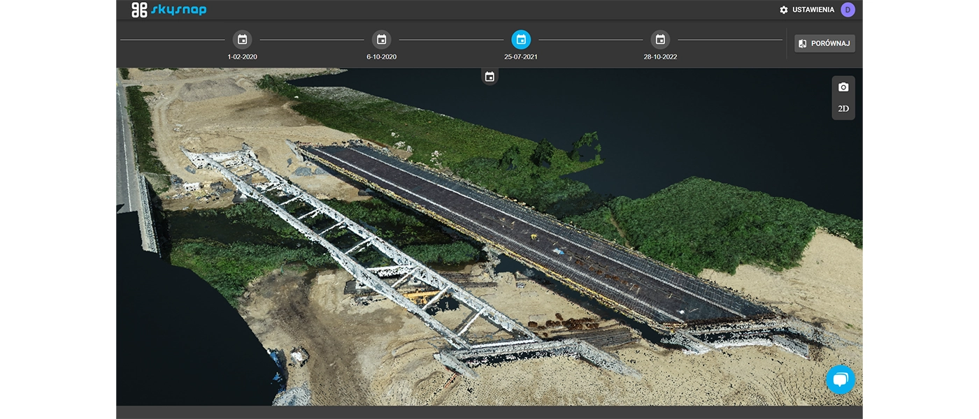
- Drone data sharing: easy visualization of orthophotos, vector data and point clouds to your clients
- Image analysis: Advanced tools for analyzing and interpreting geospatial data.
- Reporting: Automatically generate PDF reports tailored to your needs.
- On-Call Map: Integration with TaskList PRO to make commissioned and completed survey inventories available as an interactive map.
- Earthwork Progress Monitoring: Calculating the volume of earth masses and comparing actual with design assumptions.
- Generating Cross Sections: Create cross sections based on drone and design data.
- Online Access: Access data and tools from anywhere and from any device.
- Decision Support: The Skysnap portal is an indispensable decision support for complex infrastructure and construction projects at every stage of the project lifecycle.
SkySnap is an ideal solution for surveyors and drone companies that want to streamline their work processes, increase operational efficiency and improve the quality of their services. For more information about the portal, visit the SkySnap website. Package prices start at $249 and vary depending on the number of projects and camera resolution. You can find the full price list of the SkySnap portal on the price list page.
Specification SkySnap Portal
 Do you need help?Get expert adviceWe answer promptly, and make the most interesting questions available to everyone.
How can you make money with drones?


 Drone service
 Rental
 Reliability
 Trust
Trust Own warehouse
  Warranty

