
DJI Terra - What is the Terra software used for, and which version should you choose?
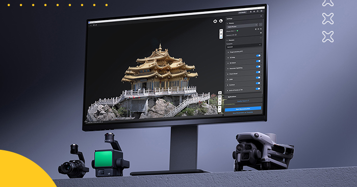
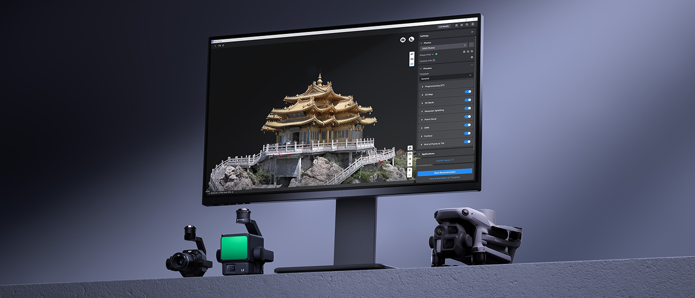
DJI Terra This is software for processing drone data that converts images and data LiDAR data and multispectral data into finished orthophotomaps, point clouds, digital elevation models, and 3D building models and larger areas. If you fly a surveying drone and end up with several hundred or several thousand photos after returning from the field, Terra is the very part of your workflow that turns that data into useful information.
The program supports 2D and 3D reconstruction, photogrammetry, LiDAR data, multispectral reconstruction, and newer technology 3D Gaussian Splatting. When combined with DJI Enterprise devices, it creates a single ecosystem that spans from data collection to a finished map or model.
Currently, in August 2026, the latest version is DJI Terra 5.3.0. Among other things, the update introduced 2D thermal reconstruction, rolling shutter correction, model creation based on frames extracted from video footage, and cluster computing for Gaussian Splatting.
What is the Terra " DJI " used for??
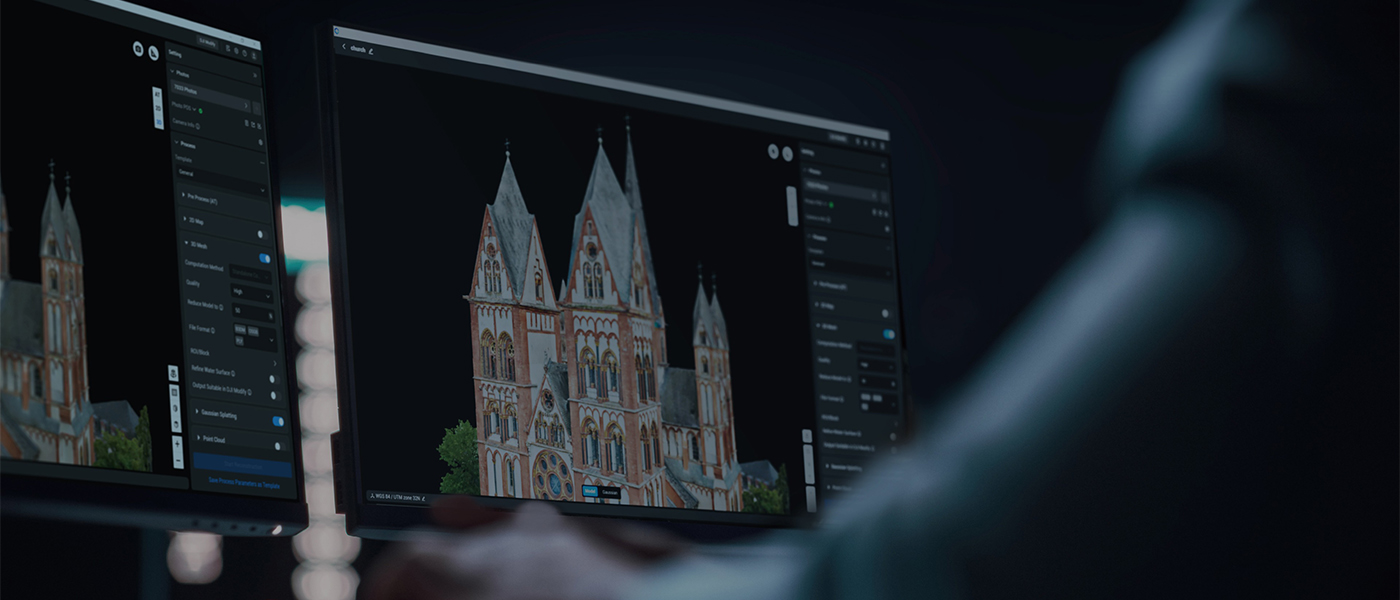
Simply put: DJI Terra is used to transform raw data from a drone into materials that can later be used to measure, analyze, design, or present terrain and objects.
From a photogrammetric flight, you can obtain, among other things, a DOM/TDOM orthophoto map, a digital surface model (DSM), a point cloud, or a textured 3D model. Terra saves 2D reconstructions in formats such as GeoTIFF, In contrast, for 3D reconstruction, formats such as OSGB, B3DM, S3MB, PLY, OBJ, FBX, I3S, LAS, LAZ, and PNTS are available.
In practice, this means using the Terra DJI in fields such as surveying, construction, project progress documentation, infrastructure inventory, the energy sector, precision agriculture, inspections, and the creation of digital models of real-world objects.
If you're not entirely sure how photogrammetry and laser scanning differ, it's a good idea to read our guide first Drone Photogrammetry – What It Is and Which Drone Is Best for It?. We also discuss LiDAR technology in more detail in the article LiDAR – What It Is in the World of Drones?.
Important: Think of the modern DJI Terra primarily as a data processing program, rather than the primary tool for planning typical airstrikes. Starting with version 5.0.0, DJI has significantly reduced its route-planning features, and in the current ecosystem, a large portion of missions are prepared in DJI Pilot 2.
Key Features of DJI Terra
2D Reconstruction – Orthophoto Maps and Surface Models
One of the core features of DJI Terra is the creation of orthophoto maps from photos taken during the air raid. This is not just an ordinary panorama made up of photos. The program calculates the positions of individual photos and the terrain geometry, so you end up with material that preserves scale and spatial reference.
DJI Terra can generate DOM/TDOM and DSM in GeoTIFF format. TFW and PRJ files containing the information needed to further work with spatial data are also created automatically. You can later open the results in compatible GIS or CAD software.
This solution is particularly useful for surveying terrain, documenting construction sites, comparing changes over time, or preparing background data for further design work.
3D Reconstruction – Building and Infrastructure Models
Terra can use a set of overlapping images to reconstruct the geometry of an object or an entire area. This is how 3D models of buildings, roads, bridges, industrial facilities, and entire sections of the city.
You can choose high, medium, or low resolution for the reconstruction.DJI It defines them as full, half, and one-quarter resolution, respectively, and the approximate ratio of computation time is about 16:4:1. In other words: the highest quality may require many times more time than a quick working reconstruction.
If you want to see a practical example of this workflow, check out our DJI Matrice 4E test for 3D infrastructure modeling.
LiDAR Data Processing
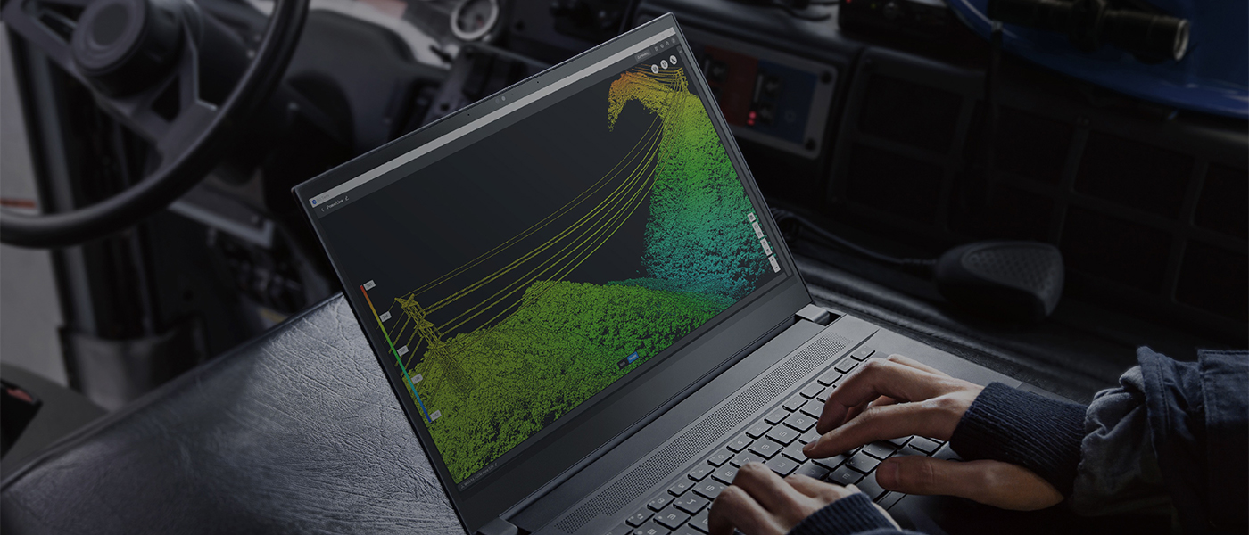
DJI Terra supports LiDAR data collected by compatible sensors DJI. This is particularly important in situations where photogrammetry alone begins to reach its limits—for example, in areas covered with vegetation or when accurately mapping terrain features.
You can use the data to create a point cloud and use it for classification, elevation analysis, measurements, generating terrain models, and subsequent stages of work in GIS/CAD software.
Terra also allows users to combine LiDAR data with images captured in visible light. When used with a compatible Zenmuse LiDAR sensor, a single dataset can be used to generate a point cloud, a 2D map, and a 3D mesh model.
Multispectral Data and Agriculture
Terra integrates data from, among others, DJI the Mavic 3 Multispectral and the Phantom 4 Multispectral. The program can generate maps of vegetation indices, including NDVI and NDRE, as well as perform radiometric correction and prepare reflectance maps.
This has a specific application in precision agriculture: you can check for differences in plant health, identify uneven crop growth, and prepare data for further analysis.
Importantly, 2D multispectral reconstruction is also available with the Agriculture license. The current documentation at DJI explicitly lists it as one of the features of this version.
3D Gaussian Splatting
One of the biggest changes in the newer versions of DJI Terra is 3D Gaussian Splatting, that is, a reconstruction method focused primarily on a highly realistic representation of the scene's appearance.
Compared to the classic mesh model, Gaussian Splatting handles complex geometry, thin elements, vegetation, scaffolding, and transparent and reflective surfaces very well. However, this does not mean that it automatically replaces traditional photogrammetry. Mesh remains the more natural choice when technical operations on geometry and compatibility with other programs are important.
According to DJI, a single 3DGS reconstruction block can be completed in less than 40 minutes. The manufacturer's test used Matrice 4E media, approximately 300 photos per block, an overlay with 70% lateral and 80% longitudinal coverage, and a high-performance workstation with 64 GB of RAM. The actual time will, of course, depend on the data and the computer.DJI It also states that more than 6 GB of available GPU memory can speed up 3DGS calculations by about 30%.
Gaussian Splatting is not included in the Standard license—you need at least DJI Terra Flagship.
Thermal reconstruction and video footage
Terra 5.3.0 also includes features of interest to users performing inspections. The program supports 2D thermal reconstruction with temperature measurements and the creation of a 3D reconstruction based on frames automatically extracted from the video.
A rolling shutter correction feature has also been added to improve results for high-speed photos, along with the ability to process Gaussian Splatting on a cluster of computers.
Cluster Computing
With several thousand photos, even a very powerful workstation can become a bottleneck. DJI Terra Cluster solves this problem by distributing the computations among several computers on the same network.
One computer serves as the control unit, while the others function as computing nodes. This solution is primarily intended for companies that regularly process very large projects—entire cities, long stretches of infrastructure, or exceptionally heavy 3D models. For typical raids covering a single construction site, Cluster would simply be overkill..
DJI nd Terra License Versions—Which One to Choose?
DJI Terra is a single program, but the range of available tools depends on the activated license.
The scope of the current Standard, Flagship, and Cluster editions is consistent with the current licensing offerings for DJI and MEGADRON. In the case of Agriculture, however, we would like to point out an important detail: the official documentation at DJI indicates support for 2D Multispectral Reconstruction, That is precisely why we are using this range in the summary.
The Standard will be the most practical option for most surveying, construction, and traditional photogrammetry firms. You get orthophotos, 3D models, LiDAR point clouds, and terrain results without paying extra for features you may never use.
Choose "Flagship" if you actually need Gaussian Splatting or features designed for more advanced applications and the energy sector.. The mere fact that this is a “higher-end” version does not automatically mean it will be a better purchase for everyone.
A cluster only makes sense when the scale of the work is truly large. If you regularly process thousands of photos and the wait time for your workstation directly affects the profitability of your jobs, then distributing the computations begins to make economic sense.
It's also worth keeping in mind that there are perpetual licenses. "Lifetime" does not mean that all future updates will be free here.DJI provides, for a permanent license, one year of free updates from the first activation. After that time, you can continue to use the versions and features made available during the update period.
DJI Terra: Online or Offline?
Here, the difference is simpler than it might seem.
The Online License requires an internet connection when using paid features. The license is activated on the DJI account and assigned to a specific computer.
An offline license allows you to use the program's features without an internet connection. This solution is designed for companies operating in closed networks, organizations that process sensitive data, and computers that, for security reasons, should not have network access. The range of basic online and offline computational functions is the same.
However, offline mode has several limitations regarding network services.DJI It lists, among other things, the inability to load maps and search for locations, unlock GEO Zones, and submit error reports directly.
If you work at a regular surveying or construction office with standard internet access, Online is simply more convenient. We would make purchases offline only when the lack of internet access is due to actual project requirements or company security policies, not “just in case.”.
Also, make sure to assign a license to the device. For a single-user license, DJI currently allows one device to be disconnected per calendar year. With a license covering three devices, two such submissions are allowed.
DJI Terra System Requirements
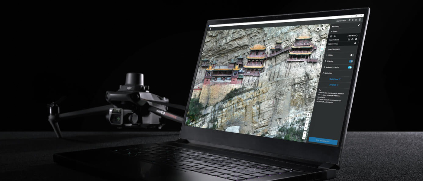
We won't beat around the bush here: DJI Terra needs a powerful computer, especially if you plan to regularly create complex 3D models.
The minimum requirements for standalone processing are Windows 10 or later (64-bit version), 32 GB of RAM, and an NVIDIA graphics card with at least 4 GB of VRAM and support for the computing architecture required by DJI version 6.1 or later.DJI recommends 64 GB of RAM or more and an NVIDIA RTX 2070 or higher-performance graphics card.
macOS is not supported. AMD graphics cards are also not officially supported. If you're buying a computer specifically for Terra, we wouldn't go with a Radeon just because it offers good value for money in other applications. Terra is designed for NVIDIA, and that's the ecosystem you should stick with.
RAM has a direct impact on the size of projects that can be processed efficiently.DJI It is estimated that, once the other requirements are met, every additional 10 GB of free RAM allows you to process approximately 4,000 additional photos. That's one of the reasons why, for a professional workstation running Terra, we'd opt for 64–128 GB of RAM rather than the absolute minimum of 32 GB.
For Gaussian Splatting, the minimum requirements remain at 32 GB of RAM and 4 GB of VRAM, but with a computer like that, don't expect to work comfortably on large projects. If Terra is to be a money-making tool, a more powerful NVIDIA graphics card, plenty of RAM, and a fast SSD are time-savers, not luxuries.
DJI Terra, DJI Modify, and DJI Reality—how do they differ??
These are three different tools, and it’s important to understand their roles before you buy them.
DJI Terra is primarily responsible for data reconstruction and processing. Upload photos or LiDAR data and create an orthophoto map, point cloud, DSM, or 3D model.
DJI Modify It picks up where Terra's editing capabilities become too basic. Among other things, the program allows users to smooth and denoise point clouds, perform downsampling, classify points, and repair mesh models. It can remove floating fragments, smooth surfaces, fill in holes, improve textures, and fix water surfaces. Terra and Modify are directly integrated, so a model can be transferred for editing in essentially a single step.
And here we have one of our biggest concerns about the entire system: advanced editing of a finished model requires a separate DJI Modify. Given the price of Terra's professional software, we would like to have at least some of these tools available right away. From the user's perspective, this represents an additional cost and yet another license to manage.
DJI Reality plays a much simpler role. It is a lightweight model viewer for Windows, designed to open data very quickly, check the quality of the reconstruction, and provide basic navigation of the finished model. It is not a replacement for Terra or Modify—it is primarily designed for conveniently viewing results.
So it's very easy to remember: Terra creates, Modify improves, and Reality displays.
Pros and Cons of the Terra DJI
Pros: Excellent integration with drones and sensors— DJI, and Enterprise; support for photogrammetry, LiDAR, and multispectral data in a single environment; orthophotos, DSMs, point clouds, and 3D models; a wide range of export formats; direct integration with DJI Modify; Gaussian Splatting in higher versions; ability to scale computations via a cluster; offline version for environments without internet access.
Cons: No macOS support and no official support for AMD GPUs; high system requirements for larger projects; Gaussian Splatting requires the Flagship version or higher; advanced model editing has been moved to a separate DJI Modify; perpetual licenses do not guarantee free updates indefinitely; the Online/Offline licensing system and its various options may be confusing at first.
Does the Terra DJI work without an internet connection??
Yes, but you need an offline license. Standard and Flagship are available in both online and offline modes, while Cluster operates as an offline solution. The Online version requires an internet connection for authorization and to use paid features.
Does " DJI " Terra work on a Mac??
No.DJI officially requires Windows 10 or later (64-bit version). macOS is not supported.
Does " DJI " Terra work with an AMD graphics card??
This is not an officially supported configuration.DJI Requires a graphics card NVIDIA and clearly indicates that Terra is not compatible with AMD GPUs.
Does DJI Terra create orthophoto maps??
Yes. This is one of the program's basic uses. Among other things, Terra creates DOM/TDOM and DSM in GeoTIFF format, which can then be used in further surveying and GIS work.
Does the DJI Terra support LiDAR??
Yes. The Standard edition and higher allow you to process LiDAR data into point clouds and terrain models, among other formats.DJI It is also developing the integration of LiDAR data with images captured in visible light.
Is it possible to test the DJI Terra before purchasing it??
DJI offers a trial version. The current terms and conditions provide for one month of access, up to 500 photos in the reconstruction, limit 8 GB of LiDAR data, one workstation and the requirement to use the latest version of the software with Internet access.
If you're not sure whether your computer can handle typical projects or whether you need the Standard or Flagship model, testing it with actual data from your own work is a much better way to find out than just comparing spec sheets.
Our Review: Is the Terra DJI Worth Buying??
If you work with DJI Enterprise drones and if you want the transition from an aerial survey to an orthophoto, point cloud, or 3D model to be as simple as possible, DJI Terra is a very sensible solution. The biggest advantage is the ecosystem's consistency: the hardware, RTK data, cameras, LiDAR, and software are designed to work together without having to build a workflow from several unrelated programs.
For most companies involved in surveying, photogrammetry, and construction, we would choose DJI Terra Standard. It offers the most essential tools for 2D, 3D, and LiDAR reconstruction without having to pay for features that will go unused.
A flagship model makes sense if you know why you're buying Gaussian Splatting or features related to advanced inspections and energy. We wouldn't choose it just because it's the top-of-the-line classic version.
We recommend the cluster only to companies that regularly undertake truly large projects. For individual building models or standard investment projects, it's better to allocate part of the budget to a faster workstation.
In agriculture, on the other hand, it is worth considering Agriculture, if the scope of work actually ends with mapping fields, orchards, and multispectral data.
However, we do have one specific “but”: we’d like Terra to have more robust tools for refining finished models. Today, when it comes to more serious editing, the next step is practically a given: DJI Modify, that is, a separate program and a separate license. The workflow itself is very good, but this makes the cost of the entire set significantly higher.
If you're considering a purchase, don't choose a license based solely on the version name. Tell us what kind of drone you use to collect data, whether you work with photos or LiDAR, how large your flight operations are, and what kind of final product you need to deliver to the client. We'll help you choose the right version of DJI Terra for your specific needs, rather than selling you features you'll never use.