
A Pilotless Drone on a Construction Site—How Aviation Automation Is Changing the Polish Construction Industry

The Polish construction industry is one of the largest sectors of the economy—in 2024, the 15 largest construction companies generated a combined total of 47 billion zlotys in revenue. Budimex, Strabag, PORR, Skanska, Warbud—dozens of projects are underway simultaneously at their construction sites, each requiring regular progress reports, health and safety inspections, and reporting to the client. Meanwhile, most of them still rely on occasional drone flights with a pilot on site.DJI Dock 3 changes this fundamentally: automatic construction monitoring using a drone According to the schedule, 3D models are uploaded to the cloud after each flight, and reports are automatically generated and sent to the construction manager's inbox.
Many construction managers and supervising engineers are looking for autonomous drone-based construction site monitoring - In practice, this is exactly what DJI Dock 3 offers: automated flights according to a schedule, full human control at any time, and data available to all stakeholders via a link without the need to create an account.
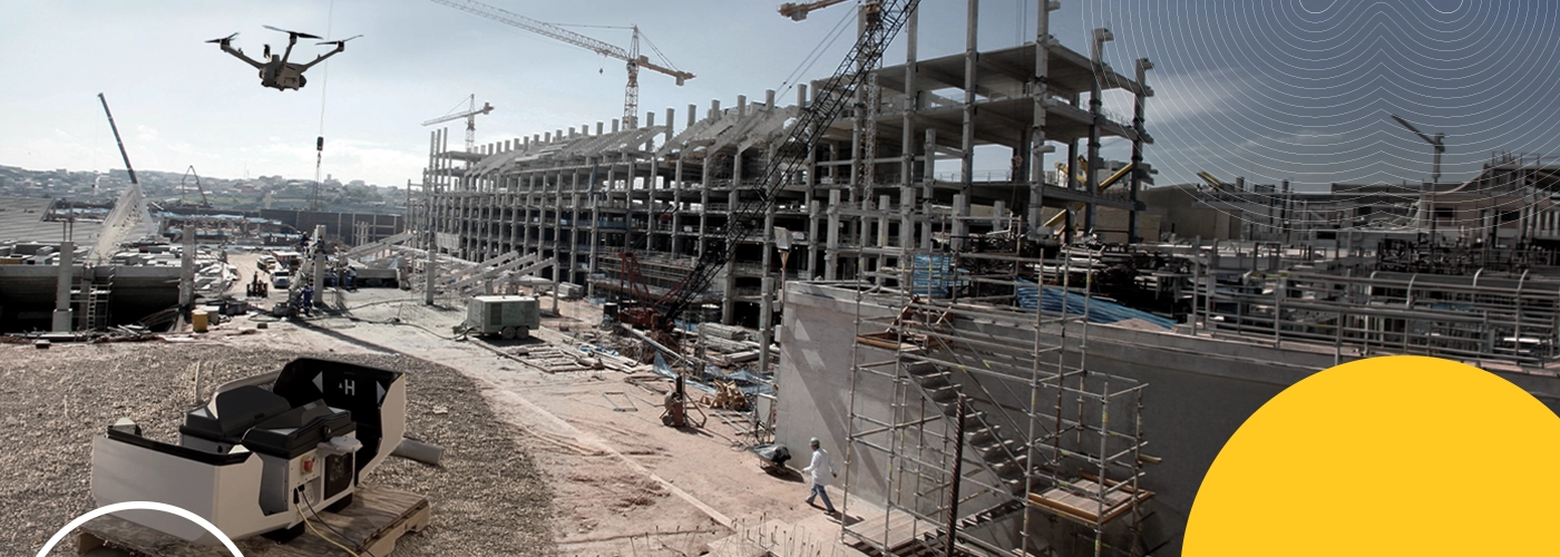
The Polish Construction Industry: The Scale of the Challenge
Why Traditional Drone Monitoring Is No Longer Enough?
The Polish construction industry is in the midst of an infrastructure boom. GDDKiA is carrying out several dozen road construction projects, PKP PLK is modernizing railway lines, and developers are building housing developments in every major city. Budimex is already using drones for surveying and to estimate the volume of bulk materials - This confirms that leaders in the Polish construction industry view BSP as a standard, not an experiment.
However, the challenges are real: preparing documentation for the investor takes time and money, discovering an error after the fact leads to costly rework, and a lack of ongoing insight into the progress of the work results in delays. A huge wave of contracts related to the CPK is coming—that means thousands of hectares of construction sites that will need to be monitored precisely and regularly.
Automatic terrain digitization—the foundation of all applications
3D Reconstruction and GCP—Centimeter-Level Accuracy for Polish Projects
FlightHub 2 supports full cloud-based reconstruction: you import photos from an automated flight, The platform processes and returns a 2D orthomosaic map or a 3D model. No external software, no manual file copying. The system supports GCP for centimeter-level accuracy and Polish coordinate systems—the data can be used directly for design work in AutoCAD or BIM.

FlightHub 2: Automatic mapping task using GCP and the Polish coordinate system. Result: a 3D model ready for measurements and comparison with the BIM design
Overlaying Design Drawings and Annotations
Project vs. reality—real-time verification in a single view
Import PDF and DXF files containing design drawings directly into the platform—overlay them onto the 3D model generated automatically, and immediately see if the work is proceeding according to the design. Annotations with automatic GPS coordinates, polylines with length measurements, and polygons with area measurements—all available via a link or QR code for the investor, construction supervisor, and designer.
Advanced Measurements in the Analyzer
Volumes, cross-sections, and change history—all in a 3D model
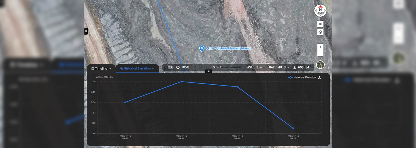
FlightHub 2 Analyzer: Point Measurement with History—A Graph Showing Changes in Terrain Elevation Between Consecutive Automatic Flights. Perfect for monitoring earthwork for foundations
- Measuring a point with a history: Week-by-week tracking of excavation depth—each automated flight updates the data. Useful for the foundation work of large-scale structures and earthwork on roads.
- Cross-section and slope: ground profile along a polyline, slope angle—essential for earthwork and flood control levees.
- Cut and fill volumes: How many cubic meters of soil were excavated or added—proof of work for the investor and the basis for settlements with subcontractors.
Automated progress monitoring—from the office, without a supervisor on-site
Mission Schedule, Change Detection, and Sharing with Investors
A waypoint mission created virtually on a 3D model from the office. Schedule: e.g., Monday, Wednesday, Friday at 7:00 a.m. — the drone takes off on its own, collects data, returns, recharges, and uploads the data to the cloud. The construction manager has the 3D model and the report in his inbox before he arrives at the site.

A 3D model generated from an automated flight, accessible via a QR code—the investor, construction inspector, and designer can view the current status of construction on their phones without needing an account DJI
The Change Detection module automatically detects differences between models from two different dates and generates a PDF report. Thanks to RTK, both models are aligned with centimeter-level precision—the changes are real, not positioning artifacts.
Automated workflow: flight → model → measurement → report
How Does Automated Data Flow Work on a Polish Construction Site??
| Stage | The Traditional Workflow in Poland | DJI Dock 3 - Automatic |
|---|---|---|
| Flight and Details | Pilot arrives at the construction site, flight, SD card | Automatic startup according to a schedule |
| Transfer | Manual copying, FTP, or a USB flash drive | Automatic Upload to FlightHub 2 |
| 3D Reconstruction | Pix4D or Agisoft—a few hours of manual work | FlightHub 2: Cloud-Based Automation |
| Measurements | Manual adjustments on the model the next day | Automatic via Analyzer |
| Investor Report | Handwritten, sent by email | Generated and sent automatically |
Automated Response to Construction Incidents
10 seconds to take off—faster than any patrol
Up and running in 10 seconds, 30 minutes of automated incident monitoring. When an incident occurs—a landslide, an accident, a fire— DJI 's Dock 3 is in the air before anyone else arrives. Rapid Mapping generates a 3D terrain model almost in real time.
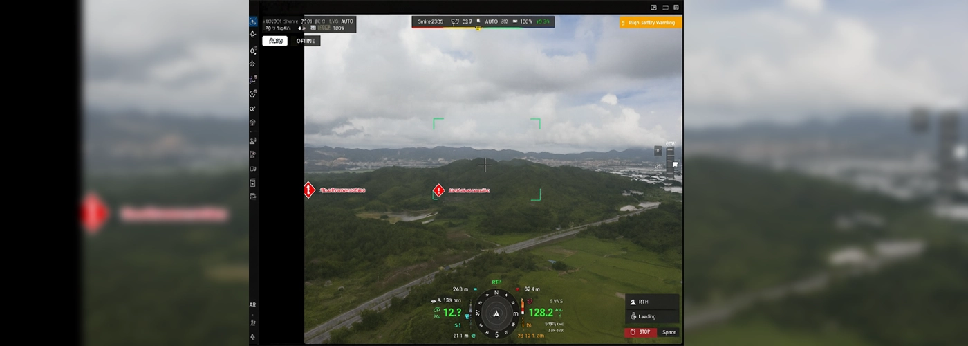
Crisis Response: Active Automatic Mission with a Designated Incident Zone—The drone documents the situation in flight, and the operator views the flight path and telemetry in real time
Implementations—How Construction Companies Are Already Doing It
Budimex - Drones in the Polish Construction Industry Today
Budimex, a leader in the Polish construction industry with revenue of 9.1 billion PLN in 2024, is already using drones for surveying and to estimate the volume of bulk materials. This confirms the trend: Poland’s largest construction companies treat aviation automation as an operational standard, not a premium option.DJI Dock 3 is the next step—autonomous flights without a pilot, data uploaded to the cloud after every flight, and reports generated without human intervention.
Housing Complex Surveillance—Automatic Flights 3 Times a Week
A construction company building a residential complex in a metropolitan area (12 buildings, 3 years of construction) has implemented DJI Dock 3 for automated monitoring of the construction site. Parameters of a typical unmanned mission:

Financing the Purchase of a DJI Dock 3 in Poland
Financial Instruments Available to Construction Companies and Real Estate Developers
Polish construction companies can finance the purchase of a 3-meter Dock DJI .in. by:
- Operating Lease - DJI Dock 3 as a fixed asset; the cost is included in the projects
- Depreciation - a one-time write-off by KKIS for equipment below a specified threshold
- EU Funds for SMEs - digitization and automation of processes under the FENG and FEW programs
- BGK Investment Loan - dedicated lines for construction companies and developers
Automate the monitoring of your construction site—check out Dock 3 in action at DJI
As the official partner of DJI in Poland, we conduct live demonstrations at your construction site. We'll show you how to generate a 3D model, obtain earthwork volume measurements, and produce a report ready to send to the client—all in a single automated flight..
- Live demonstration at your facility—free of charge
- ROI Analysis for Your Project Portfolio
- Draft Schedule for Automated Missions
- Integration with Your Construction Management and BIM System
- UAV Operator Training and VLOS/BVLOS Certification
- Warranty and Post-Warranty Service in Poland