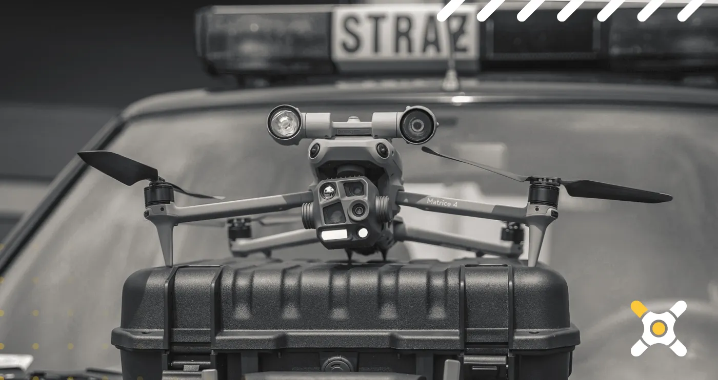
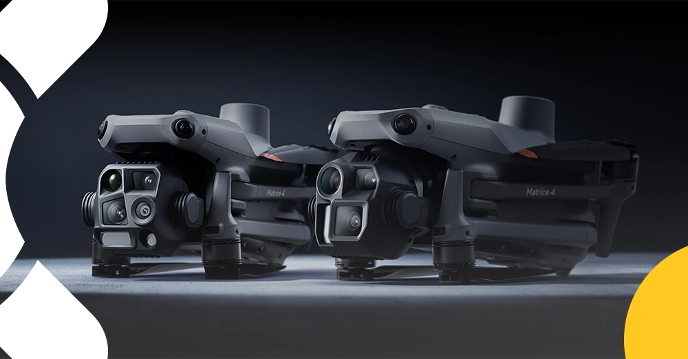
The DJI Matrice 4T C2 is a powerful, feature-packed drone built for users who need sharp imaging, dependable flight performance, and advanced tools for demanding aerial missions. Combining a compact design with professional-grade capabilities, it is a great choice for infrastructure inspection, search and rescue, environmental monitoring, site observation, and public safety operations.
Equipped with a thermal camera, AI-assisted detection, a laser rangefinder, and the advanced DJI RC Plus 2 Enterprise controller, the Matrice 4T helps you capture accurate data, react faster in the field, and fly with more confidence—even in challenging conditions.
If you are looking for a versatile drone solution for technical inspections, crisis management, forestry, rescue support, or advanced aerial observation, the DJI Matrice 4T delivers the performance and flexibility to get the job done.
Thermal imaging camera for advanced inspection and observation tasks
3x and 7x tele cameras plus wide-angle camera for flexible image capture
Built-in laser rangefinder with measurement range up to 1800 m
AI-powered detection of people, vehicles, and boats in real time
Night mode, NIR auxiliary light, and gimbal-mounted illumination
Up to 49 minutes of flight time
Fast deployment in as little as 15 seconds
DJI Care Plus (1 Year) included for extra peace of mind
High-Quality Imaging in Low Light
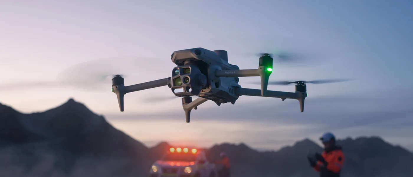
The DJI Matrice 4T is designed to maintain visibility and control even after dark. Advanced obstacle avoidance, dedicated night mode, NIR auxiliary lighting, and gimbal-mounted illumination help you perform missions more safely and accurately in low-light environments. Whether you are inspecting structures at dusk or operating during nighttime response scenarios, this drone helps you stay effective when visibility drops.
Advanced Camera System for Inspection and Photogrammetry
Thermal Camera
7x Tele Camera
3x Tele Camera
Wide-Angle Camera
Laser Rangefinder
640 × 512, f/1.0, 53 mm equivalent focal length
UHR infrared image mode with image resolution up to 1280 × 1024
1/1.5-inch CMOS sensor, 48 MP effective pixels
f/2.8 aperture, 168 mm equivalent
Up to 112x hybrid zoom
1/1.3-inch CMOS sensor, 48 MP effective pixels
f/2.8 aperture, 70 mm equivalent
1/1.3-inch CMOS sensor, 48 MP effective pixels
f/1.7 aperture, 24 mm equivalent
Measurement range: 1800 m (1 Hz)
Range accuracy: 0.2 + 0.0015 × D (m)
The Matrice 4T offers a versatile imaging payload for users who need both detailed close-up data and broad situational awareness. With multiple focal lengths, thermal capability, and a wide-angle lens, it is ready for inspections, mapping support, monitoring, and technical documentation. The additional NIR auxiliary light with a 6° FOV and reach up to 100 m further improves mission performance in difficult lighting conditions.
Advanced Thermal Imaging and Accurate Temperature Measurement
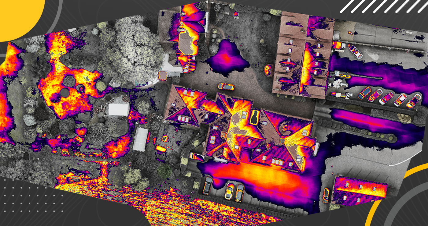
The DJI Matrice 4T features a high-resolution live thermal view for clearer visual interpretation in demanding environments. It is especially useful for search and rescue, wildlife observation, and security operations where thermal data can make all the difference. The built-in ambient temperature sensor also improves temperature measurement accuracy to ±2°C or ±2%, helping you collect more reliable data in changing field conditions.
Smarter AI-Powered Operations
The Matrice 4T uses advanced AI to detect people, vehicles, and boats in real time, making it a highly capable tool for monitoring and response missions. Intelligent flight features such as FlyTo, POI, Smart Track, and Cruise help optimize flight paths, improve tracking precision, and support safer operations. PinPoint and area or line drawing with the laser rangefinder add another layer of precision for field measurements and planning.
Crystal-Clear Detail from a Distance
The 3x zoom camera supports smooth continuous zoom with AFC for clearer visual tracking, while the 7x camera with up to 112x hybrid zoom helps reveal fine details from long distances. This makes the drone a strong choice for inspection and observation work. Combined with foreground stabilization, EIS, and electronic dehazing, the Matrice 4T delivers sharp, usable footage even when conditions are less than ideal.
Faster Takeoff, Greater Safety
When time matters, the Matrice 4T can be mission-ready in as little as 15 seconds. It also supports transmission distances up to 25 km and works with the DJI D-RTK 3 base station for higher positioning precision. GNSS anti-interference protection, combined with upgraded positioning through GNSS and vision fusion, helps maintain reliable and stable flight even in environments with significant electromagnetic interference.
Efficient Performance and Long Flight Time
With up to 49 minutes of flight time, the DJI Matrice 4T is built for longer missions with fewer interruptions. A maximum speed of up to 21 m/s helps you move quickly between waypoints, while the operational range supports work across larger areas. It is a practical choice for users who need endurance, mobility, and dependable performance in the field.
Support for DJI Cellular Dongle 2
The Matrice 4T supports 4G transmission via the DJI Cellular Dongle 2, helping maintain a more stable connection in areas with weaker network infrastructure. This added connectivity improves communication reliability and data access during demanding field operations.
Advanced Photogrammetry Missions
3-Directional Ortho Capture helps improve mission efficiency by capturing oblique images during photogrammetry flights, allowing you to gather more useful data in a single operation.
5-direction oblique capture enhances workflow efficiency for digital twin creation and 3D visualization, giving users more complete image coverage and more precise terrain models.
Measurement quality reports are generated automatically, making it easier to verify data completeness and maintain high standards during every photogrammetry mission.
DJI Matrice 4T Functionality
This drone is built to handle a wide variety of tasks. Smart 3D Capture supports autonomous 3D missions based on point clouds, making it especially useful for creating digital twins. The onboard laser rangefinder and area-drawing tools help users measure distances and surfaces with impressive accuracy. AI object detection can display up to 128 objects in real time and identify up to 1000 objects in a single image, giving the Matrice 4T a serious edge in analytical and operational workflows.
Automatic AI Detection
The AI-based automatic detection system can accurately identify people, vehicles, and vessels. It can display up to 128 objects in the camera’s field of view at the same time and generate alerts when detected objects cross a specified range. This makes real-time monitoring faster, smarter, and more efficient.
Object counting also works on images stored in the album, allowing identification of up to 1000 objects in a single image. To enable this counting process, AI detection must be activated before taking the photo. It is a useful feature for detailed post-mission analysis and data review.
Distance Measurement with the Laser Rangefinder
The built-in laser rangefinder provides precise real-time distance measurement for objects located in the center of the camera view. With a range of up to 1800 m and accuracy of 0.2 + 0.0015 × D, it is a valuable tool for inspection, surveying support, and mission planning.
Beyond distance measurement, the system can also provide GPS coordinates and ASL height for each measured point. By saving this information in image XMP metadata, the Matrice 4T helps speed up inspections and simplifies later analysis and documentation.
DJI RC Plus 2 Enterprise Remote Controller
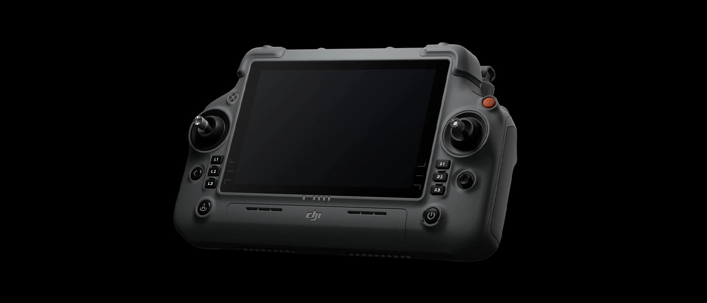
The DJI RC Plus 2 Enterprise controller is designed for demanding field use and offers a strong mix of comfort, durability, and visibility.
7.02-inch touchscreen LCD with 1400-nit brightness
1080p/30fps transmission for smooth, clear viewing
Battery life up to 7 hours
Operating temperature range from -20°C to 50°C
IP54 rating for improved resistance to dust and moisture
Compatible with WB37 batteries
Expanded Capabilities with DJI Accessories
The DJI AS1 speaker supports transmission up to 300 meters and enables more effective communication in the field. It also supports live broadcasting with echo suppression, recorded messages, and text-to-speech functionality.
The DJI AL1 spotlight can illuminate objects at distances up to 100 meters, making low-light work much easier. With Always-On and Strobe modes, plus smart gimbal-follow capability, it offers flexible lighting support for a wide range of missions.
The DJI D-RTK 3 station supports base, rover, and relay modes, delivering highly accurate GCP/CP measurement even when a network connection is unavailable. It is an excellent addition for users who need precise positioning in the field.
Specification DJI Matrice 4T Drone + DJI Care Plus (1 Year)
Brand
DJI
Symbol
CP.EN.00000545.01
Producer code
6941565994226
Warranty
24 months
Set composition
Dron Matrice 4T
DJI Care Enterprise Plus na 1 rok (aktywacja automatyczna)
DJI Terra Flagship for 3 months* (trial version, automatic activation)
Akumulator Matrice 4 x1
Aparatura sterująca DJI RC Plus 2
HUB ładowania x1
USB-C charger
Propeller Set
64GB memory card x1
Carrying case x1
User Manual
Class of drone
C2
Model
DJI Matrice 4T
Drone
Brand
DJI
Weight
Masa startowa (ze śmigłami) - 1219 g
Masa startowa (ze śmigłami Low-Noise) - 1229 g
Dimensions
Po złożeniu: 260,6×113,7×138,4 mm (dł.×szer.×wys.)
Rozłożony: 307,0×387,5×149,5 mm (dł.×szer.×wys.)
Climbing speed max.
10 m/s
Descent speed max.
8 m/s
Maks. horizontal speed (close to sea level, no wind)
21 m/s w locie do przodu
18 m/s w locie do tyłu
19 m/s w locie na boki
Maks. takeoff height
35 km (standardowe śmigła)
32 km (śmigła low-noise)
Maks. flight time
49 min (standardowe śmigła)
46 min ( śmigła low-noise)
Maks. angular velocity
35°
Maks. resistance to wind speed
12 m/s
Operating temperature
From -10°C to 40°C
Satellite navigation system
GPS + Galileo + BeiDou + GLONASS
(GLONASS is supported only when the RTK module is enabled)
Hovering precision range
±0,1 m (z systemem wizyjnym); ±0,5 m (z GNSS); ±0,1 m (z RTK)
Teleobiektyw średniego zasięgu: Pojedynczy: 12 MP i 48 MP Interwał: 12 MP/48 MP JPEG:0.7/1/2/3/5/7/10/15/20/30/60 s Inteligentne fotografowanie: 12 MP
Teleobiektyw: Pojedynczy: 12 MP i 48 MP Interwał: 12 MP/48 MP JPEG:0.7/1/2/3/5/7/10/15/20/30/60 s Inteligentne fotografowanie:12 MP
Minimalny interwał fotografowania
0.7 s
Photo format
JPEG
Maksymalna szybkość transmisji wideo
H.264: 60Mbps
H.265: 40Mbps
Video format
MP4 (MPEG-4 AVC/H.264)
Supported file system
exFAT
OŚWIETLENIE POMOCNICZE NIR
Oświetlenie podczerwone
FOV: 5.7°±0.3°
MODUŁ LASEROWY
Dalmierz laserowy
Zakres pomiaru: 1800 m (1 Hz) @20% współczynnik odbicia
Zakres padania ukośnego (odległość ukośna 1:5): 600 m (1 Hz)
Strefa niewidoczna: 1 m
Dokładność pomiaru odległości: 1-3 m: błąd systemu <0,3 m, błąd losowy <0,1 metra @1σ
Inne odległości: ±(0,2+0,0015D) (D oznacza odległość pomiaru w metrach)
Camera with Telephoto Lens
Sensor Tele
niechłodzony tlenek wanadu (VOx)
NIE WOLNO wystawiać soczewek kamery na podczerwień na działanie silnych źródeł energii, takich jak słońce, lawa lub wiązka lasera. W przeciwnym razie czujnik kamery może ulec spaleniu, prowadząc do trwałego uszkodzenia.
Tele lens
640 × 512
ISO Tele range
12 μm
Shutter Speed Tele
30 Hz
Maximum image size Tele
DFOV: 45°±0.3°
Ekwiwalent ogniskowej DJI Matrice 4T: 53 mm
Przysłona DJI Matrice 4T: f/1.0
DJI Matrice 4T Ostrość: 5 m do ∞
Zoom cyfrowy Termo
28x
Tele photo format
DJI Matrice 4T: ≤50mk@F1.0
Tele video format
DJI Matrice 4T: punktowy, obszarowy
Długość fali podczerwieni
8um to 14um
Tele shooting mode
Tryb wysokiego wzmocnienia: -20℃ do 150℃
Tryb niskiego wzmocnienia: 0°C do 550°C
Tele video resolution
White Hot/Black Hot/Tint/Iron Red/Hot Iron/Arctic/Medical/Fulgurite/Rainbow 1/Rainbow 2
Wysokie wzmocnienie: ±2 ℃ lub ±2%, w zależności od tego, która wartość jest większa
Niskie wzmocnienie: ±5 ℃ lub ±3%, w zależności od tego, która wartość jest większa
Digital Zoom Tele
1280 × 1024@30fps (włączona super rozdzielczość, tryb nocny nieaktywny)
Inne warunki: 640 × 512@30fps
Tryby robienia zdjęć Termo
Pojedynczy: 1280 × 1024/640 × 512
Interwał: 1280 × 1024/640 × 512 JPEG: 0,7/1/1/2/3/3/5/5/7/10/15/20/20/30/30/60 s
Format wideo Termo
MP4
Gimbal
Stabilization
3-axis (tilt, roll pan)
Mechanical range
Ograniczenia mechaniczne gimbala:
Tilt: -140° do 113°
Roll: -52° do 52°
Pan: -65° do 65°
Miękkie ograniczenia:
Tilt: -90° do 35°
Roll: -47° do 47°
Pan: -60° do 60°
Control range
Tilt axis: -90° to 35°
Mr.: no scope
Maks. control speed (tilt)
100°/s
Angular vibration range
±0.007°
Stopień ochrony przed wnikaniem
Brak
Sensor system
Type of sensors
Wielokierunkowy lornetkowy system wizyjny, uzupełniony o czujnik podczerwieni 3D w dolnej części drona.
Front
Zakres pomiaru binokularowego: 0.4-22.5 m
Zakres pomiaru: 0.4-200 m
Prędkość omijania przeszkód: Prędkość lotu ≤21 m/s
FOV: 90° (poziomo), 135° (pionowo)
Rear
Zakres pomiaru: 0.4-22.5 m
Zakres pomiaru: 0.4-200 m
Prędkość omijania przeszkód: Prędkość lotu ≤21 m/s Pole widzenia (FOV) - 90° (poziomo), 135° (pionowo)
Side
Zakres pomiaru: 0.5-32 m
Zakres pomiaru: 0.5-200 m
Prędkość omijania przeszkód: Prędkość lotu ≤21 m/s
FOV: 90° (poziomo), 90° (pionowo)
Lower
Zakres pomiaru: 0.3-18.8 m
Prędkość omijania przeszkód: Prędkość lotu ≤10 m/s
Pole widzenia z przodu i z tyłu wynosi 160°, a z prawej i lewej strony 160°.
Work environment
Do przodu, do tyłu, w lewo, w prawo i do góry: Delikatna tekstura na powierzchni, odpowiednie światło.
W dół: Podłoże ma zróżnicowane tekstury i wystarczające warunki oświetleniowe*, z rozproszoną powierzchnią odbijającą i współczynnikiem odbicia większym niż 20% (np. ściany, drzewa, ludzie itp.).


 Drone service
 Rental
 Reliability
 Trust
Trust Own warehouse
  Warranty