


LiDAR UNITREE L2 RM
 Drone service
 Rental
 Reliability
 Trust
Trust Own warehouse
  Warranty
Unitree L2 RM LiDAR – Compact 4D Sensor for Robotics, Mapping and Autonomous Navigation
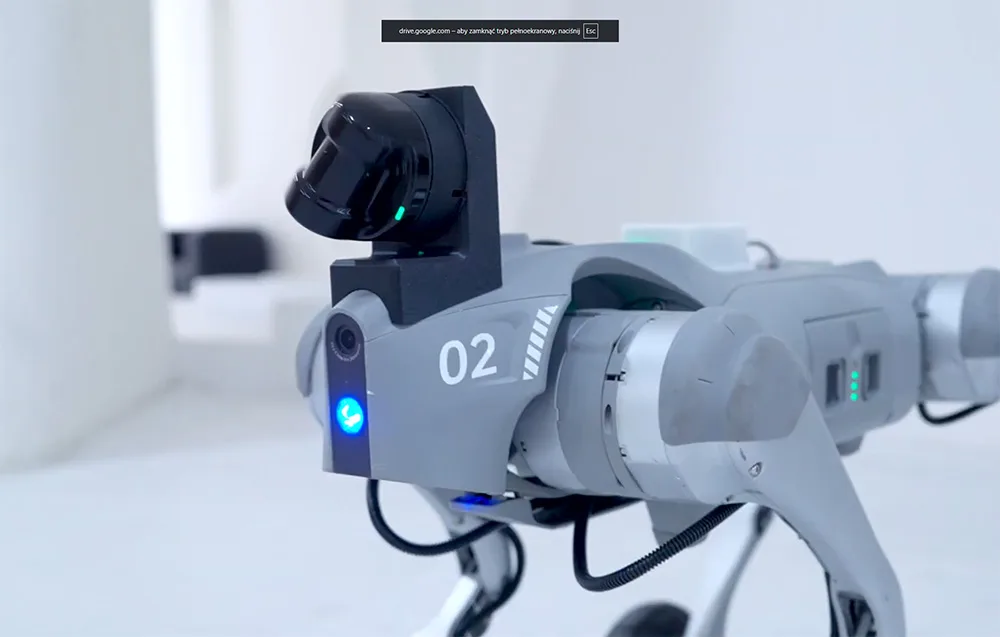
The Unitree L2 RM LiDAR is a compact, high-performance 4D LiDAR sensor built on laser Time-of-Flight technology. It generates a full 3D point cloud enriched with grayscale data, giving your robot a more complete view of its surroundings. With a 360° horizontal field of view, up to 96° vertical coverage, and a lightweight design of only around 230 g, it is a great fit for mobile robots and hobby robotics projects that need precise environmental perception for SLAM, localization, mapping, motion planning, obstacle avoidance, and autonomous movement indoors and outdoors.
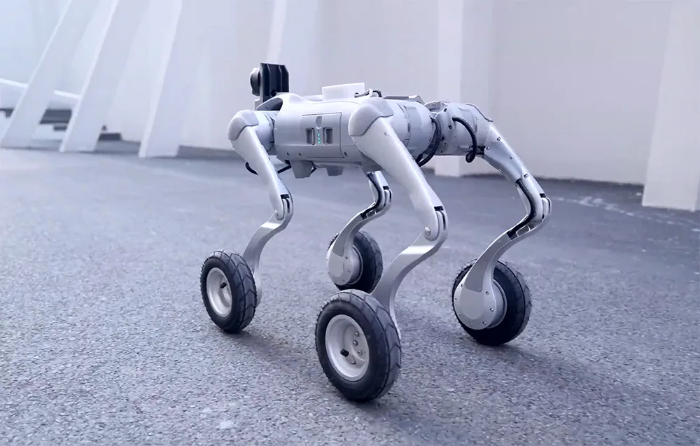
Why choose the Unitree L2 RM LiDAR?
- 4D LiDAR scanning with 3D point cloud and grayscale information
- 360° × 96° field of view for wide-area spatial perception
- Compact and lightweight design: approx. 75 × 75 × 65 mm, approx. 230 g
- Up to 128,000 points per second for dense and detailed mapping
- Measurement accuracy up to ≤ 2 cm under high reflectivity conditions
- Detection range up to approx. 30 m for highly reflective targets
- Built-in IMU with 3-axis accelerometer and 3-axis gyroscope
- Support for POINT-LIO and SLAM workflows
- Ethernet (UDP) and UART (TTL) interfaces for flexible integration
- Compatible with ROS, ROS2, and Windows
- IP54 protection and stable operation in bright environments up to approx. 100 klux
4D scanning and full environmental awareness
The L2 RM LiDAR captures space using 4D measurement technology, combining three-dimensional point positioning with an additional grayscale channel. Its ultra-wide 360° × 96° scanning coverage and minimal blind zone of only around 0.05 m allow it to map nearby surroundings with impressive precision, even close to the robot. The sensor offers a range of up to approx. 30 m for high-reflectivity objects (90%) and approx. 15 m for low-reflectivity surfaces (10%), making it a reliable choice for varied operating conditions.
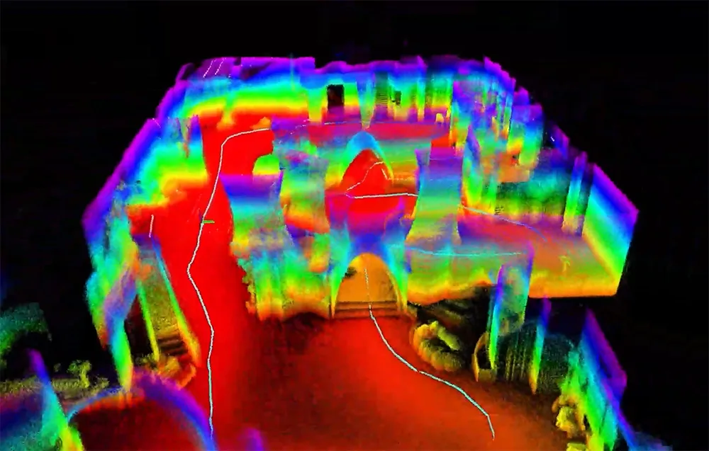
High point density and precise measurement
With a sampling rate of up to 128,000 points per second and an effective output of around 64,000 points per second, this sensor delivers dense, highly detailed spatial data. Measurement accuracy of up to ≤ 2 cm in high-reflectivity conditions, combined with a distance resolution of around 4.5 mm, helps create sharp, readable models of the environment for advanced robotics tasks.
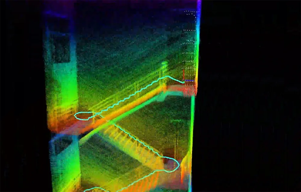
Built-in IMU and ready for SLAM
The Unitree L2 RM LiDAR features an integrated IMU with a 3-axis accelerometer and 3-axis gyroscope, enabling motion data synchronization with LiDAR scans. It also supports POINT-LIO, making accurate mapping and SLAM implementation easier without requiring extra positioning sensors. This is especially useful for hobby robotics, research platforms, and custom autonomous systems.
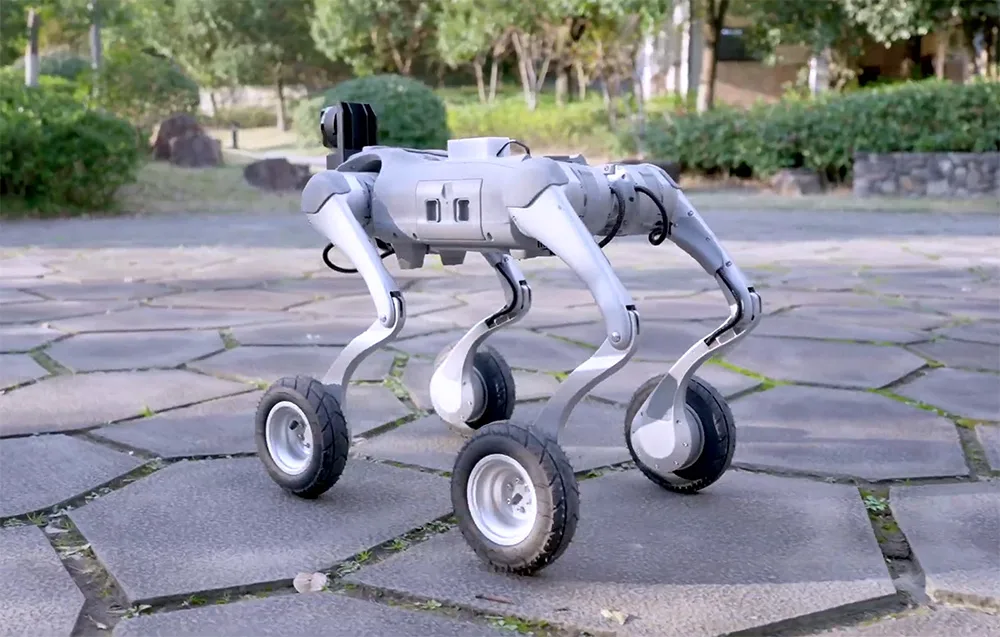
Easy integration for developers and makers
The sensor supports Ethernet (UDP) and UART (TTL) communication, making it easy to connect with different controllers, embedded systems, and robotic platforms. It is compatible with ROS, ROS2, and Windows, which makes it a practical option for development, education, experimentation, and commercial prototyping. Available SDKs and developer documentation help speed up deployment and simplify the creation of custom perception and navigation algorithms.
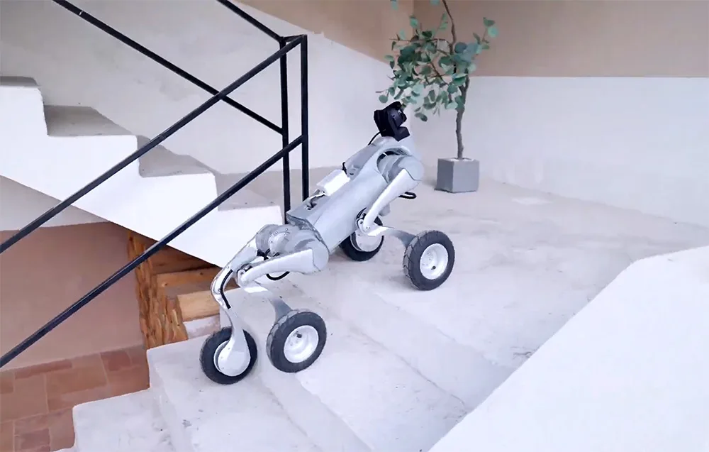
Built to handle challenging environments
The L2 RM LiDAR remains stable across a wide operating temperature range of approximately -10°C to 50–60°C. Its Class 1 laser design is safe for use around people, while the IP54 protection rating helps guard against dust and splashes. This makes it a dependable solution for robots working in a variety of indoor and outdoor environments.
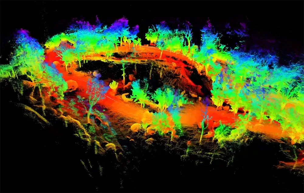
Reliable indoors and outdoors
The Unitree L2 RM LiDAR enables fast and accurate capture of full 3D indoor spaces, including room geometry and structural details that support positioning and autonomous navigation. It can also be used for more advanced tasks such as autonomous cleaning and route planning. Outdoors, the sensor maintains stable performance even in strong lighting conditions of up to approx. 100 klux, allowing for dependable measurement and accurate mapping in bright daylight.
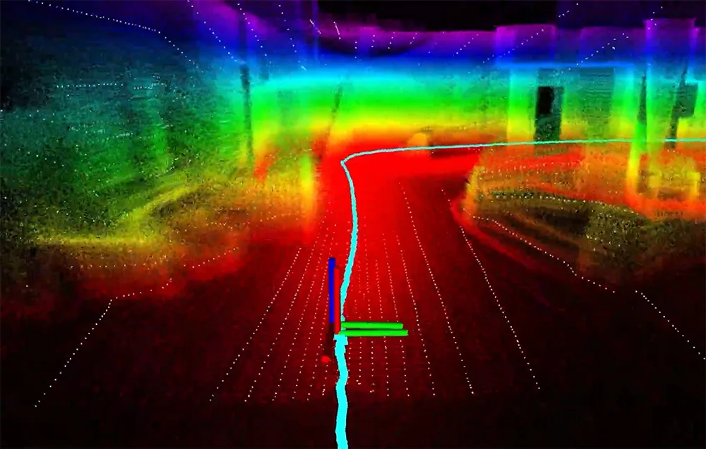
Non-repetitive scanning for cleaner spatial data
Thanks to its ultra-wide-angle scanning and non-repetitive scanning trajectories, the sensor produces a dense and precise point cloud with a highly uniform distribution of points. The result is more readable scene data and a mapping style that feels closer to photographic spatial capture, improving the quality of information used in navigation, planning, and perception systems.
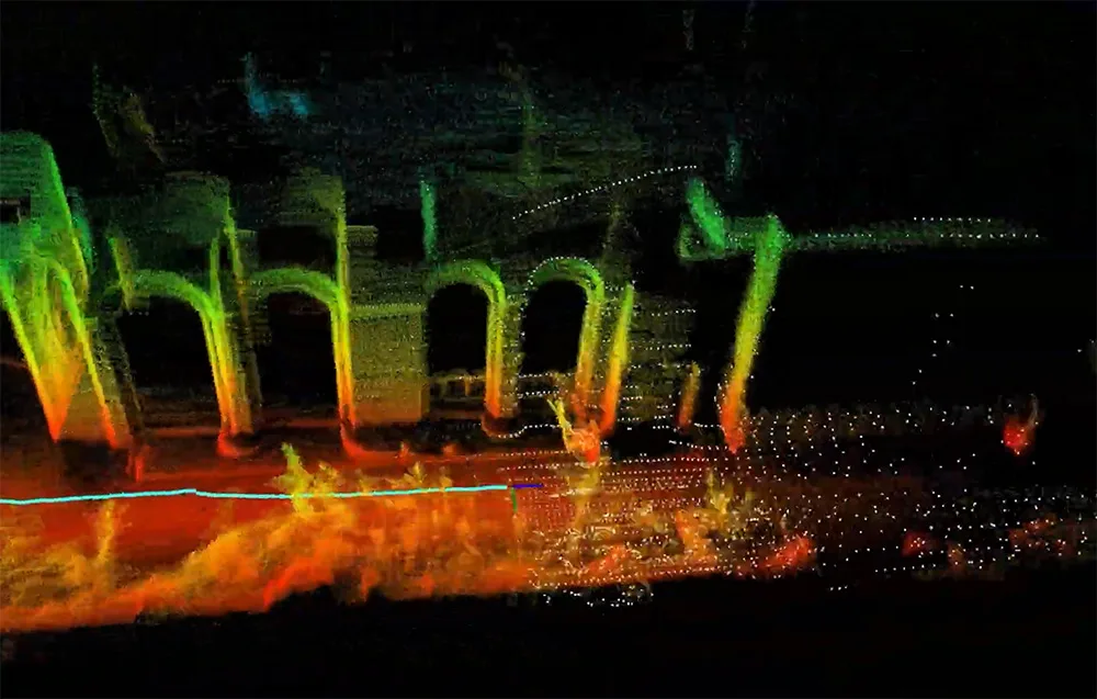
Great for a wide range of applications
The L2 RM LiDAR is a versatile sensor that can be used in logistics robots, warehouse automation, smart distribution systems, industrial projects, agriculture, factory robotics, and many other mobile robotics applications. If you are building a robot that needs reliable environmental sensing, this LiDAR gives you a strong mix of performance, compact size, and developer-friendly integration.
Technical specifications
| Brand | Unitree |
|---|---|
| Model | L2 RM LiDAR |
| Technology | 4D Laser Time-of-Flight (3D position + 1D grayscale) |
| Dimensions | Approx. 75 × 75 × 65 mm |
| Weight | Approx. 230 g |
| Field of view | 360° (horizontal) × up to 96° (vertical) |
| Minimum detection distance | Approx. 0.05 m |
| Maximum range | Approx. 30 m (90% reflectivity) / approx. 15 m (10% reflectivity) |
| Sampling rate | Up to 128,000 points/s |
| Effective point output | Approx. 64,000 points/s |
| Horizontal scan frequency | Approx. 5.5 Hz (adjustable) |
| Vertical scan frequency | Approx. 216 Hz |
| Measurement accuracy | ≤ 2 cm (for high reflectivity) |
| Distance resolution | Approx. 4.5 mm |
| IMU | 3-axis accelerometer, 3-axis gyroscope |
| Output data | 3D point cloud + grayscale value |
| Operating modes | 3D, 2D, extended field-of-view mode |
| Interfaces | Ethernet (UDP), UART (TTL) |
| SLAM support | POINT-LIO |
| Compatibility | ROS, ROS2, Windows |
| Laser class | Class 1 (eye-safe) |
| Light resistance | Stable operation up to approx. 100 klux |
| Operating temperature | Approx. -10°C to 50–60°C |
| Protection rating | IP54 |
Specification LiDAR UNITREE L2 RM
 Get expert advice