Drone service
 Rental
 Reliability
 Trust
 Own warehouse
 Warranty
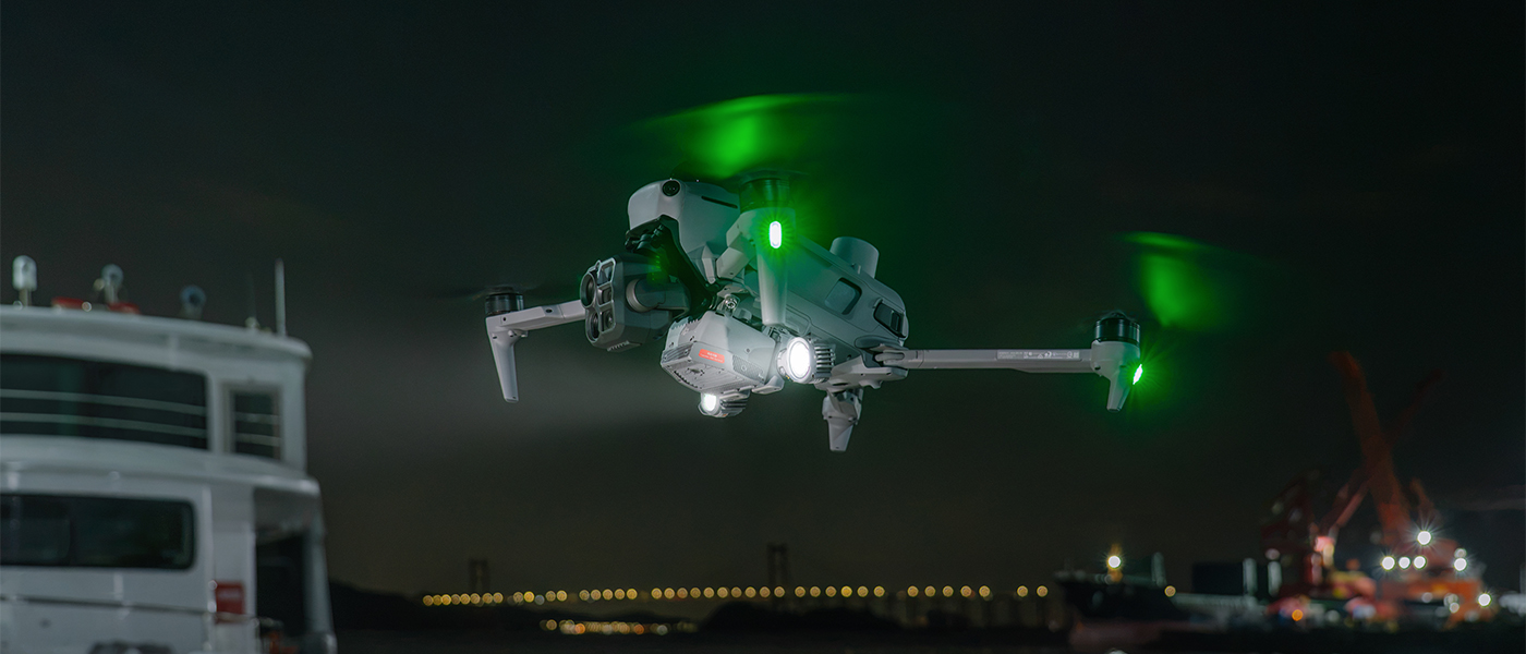
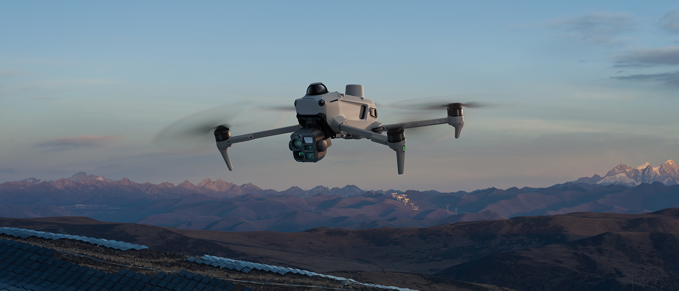
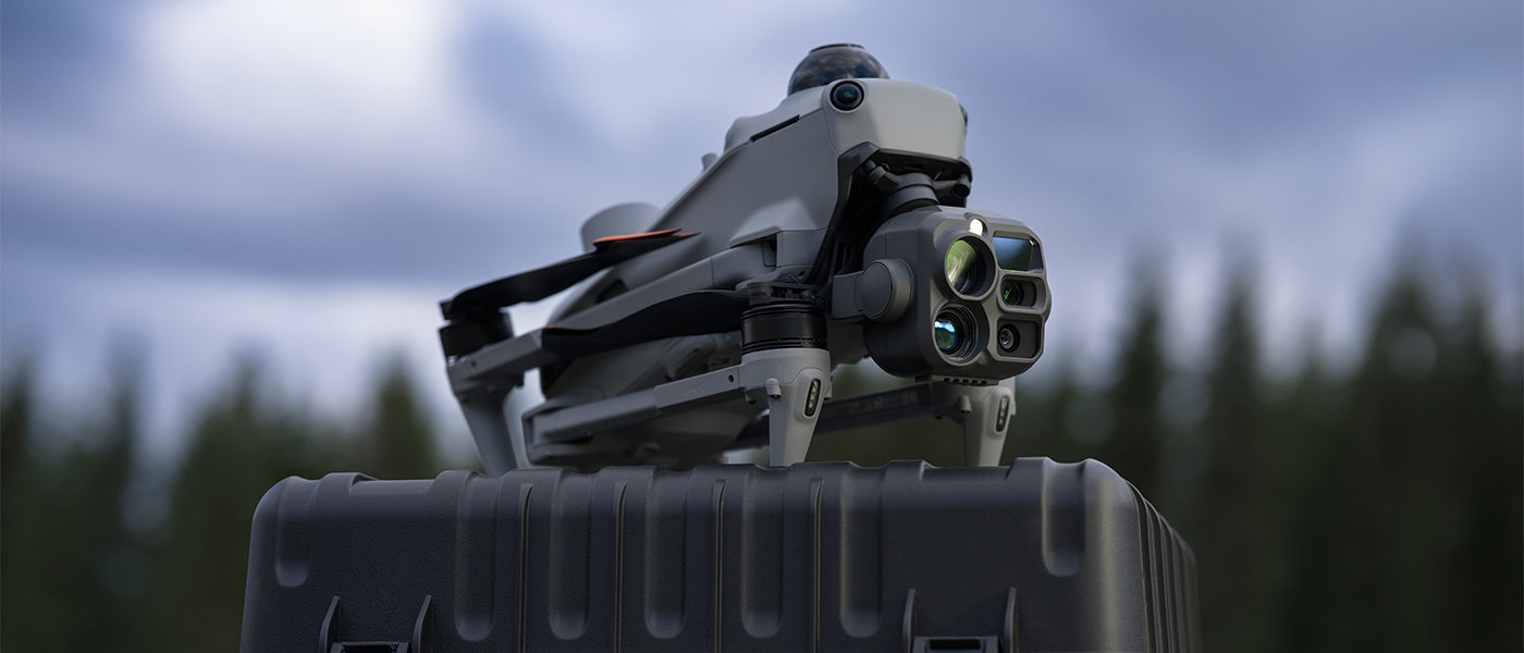
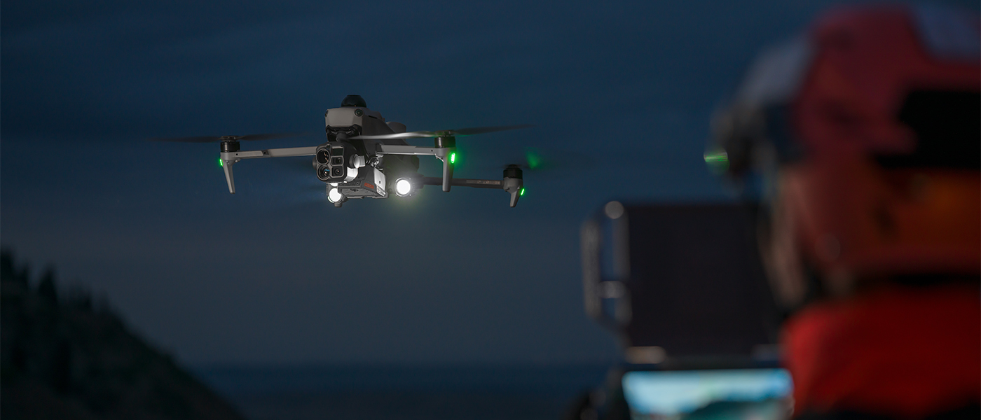
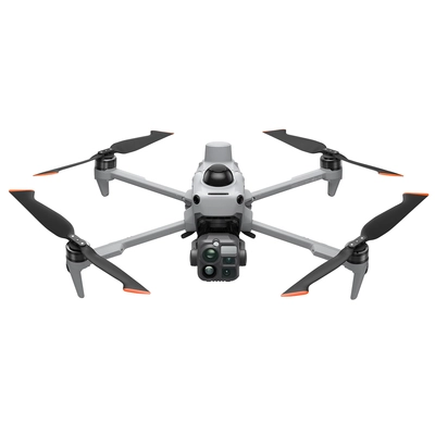
DJI Matrice 5T Drone

8 079,70 €
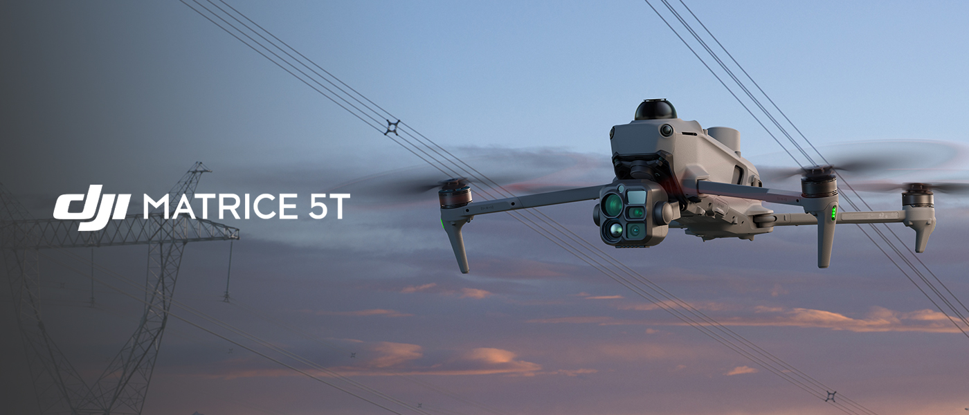
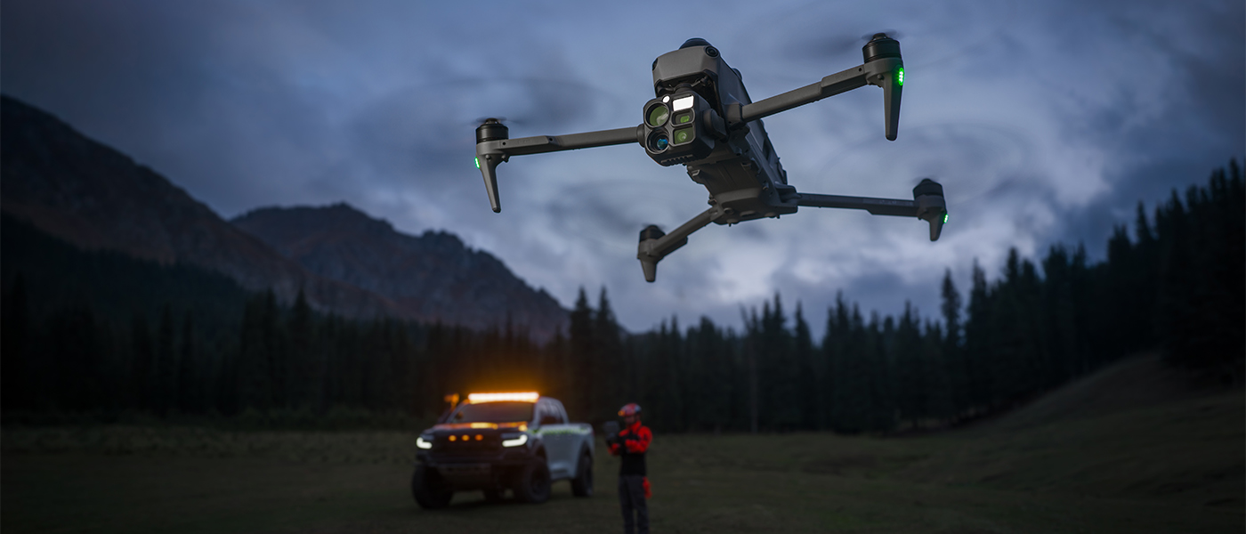
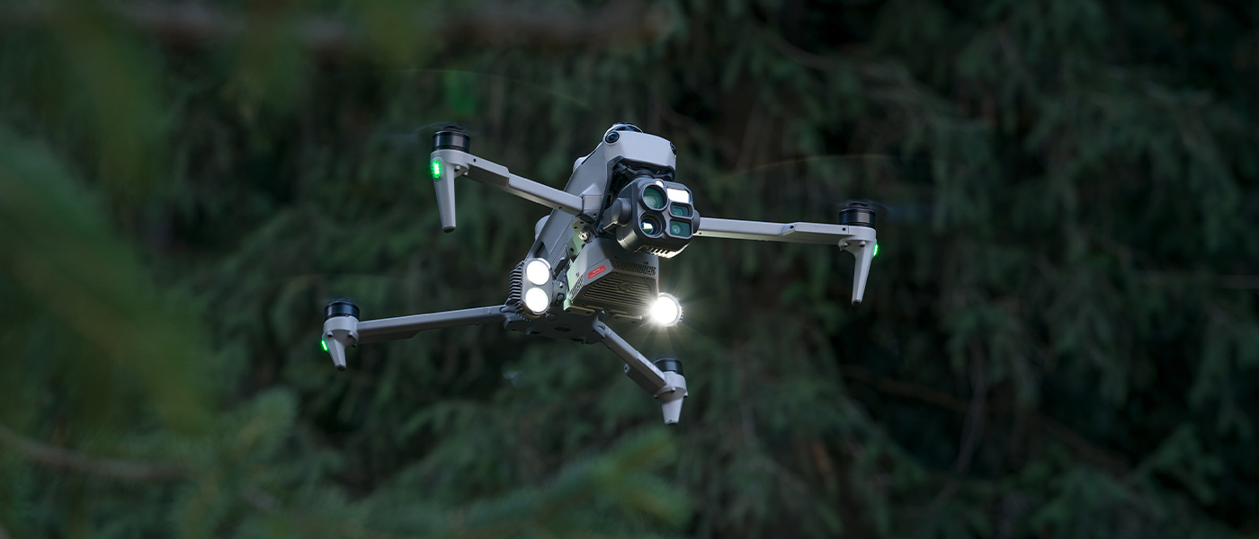
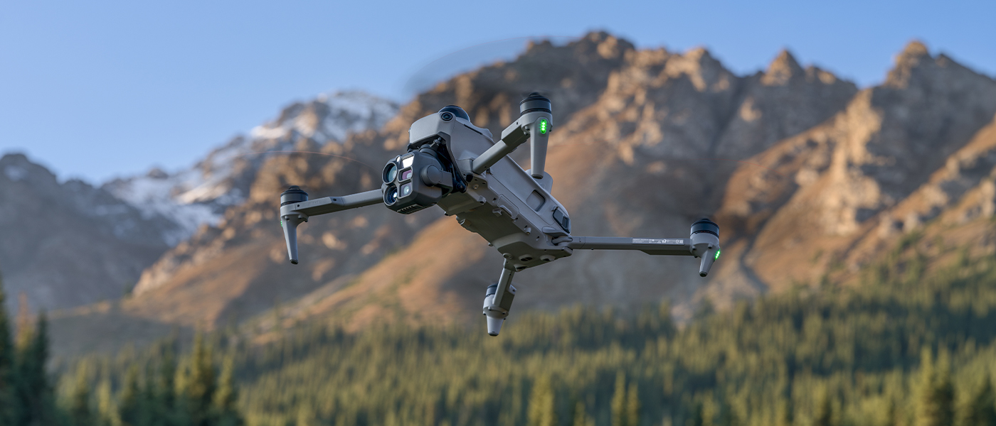
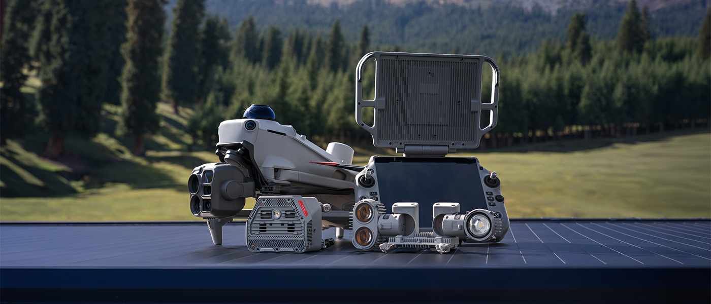
DJI Matrice 5T – a thermal drone for rescue, inspection and mapping
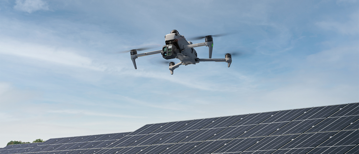
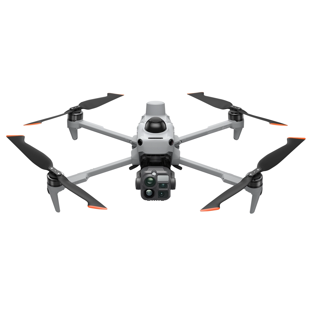
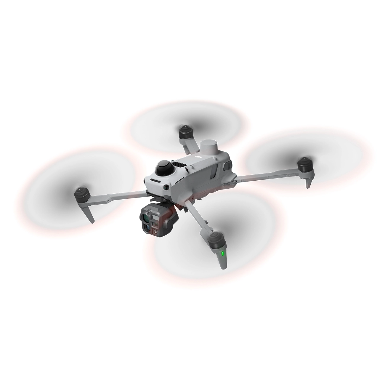
DJI Matrice 5T combines 1280 × 1024 thermal imaging, three visible-light cameras and a laser rangefinder in a foldable platform for professional applications. It supports searches for people, power infrastructure inspections, area monitoring and data collection for maps and models. One drone lets you combine these tasks within the same mission.
Up to 59 minutes of flight time, an IP55-rated enclosure and an obstacle sensing system using LiDAR, mmWave radar and vision sensors support operations in challenging environments. Onboard AI helps detect objects, while automation reduces the number of tasks you need to carry out manually.
1280 × 1024 thermal camera – easier assessment of heat sources
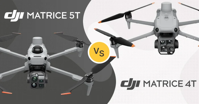
A native resolution of 1280 × 1024 provides four times as many pixels as the Matrice 4T thermal camera. Greater image detail helps distinguish silhouettes during searches and examine components showing abnormal heating. The camera operates at 30 Hz and offers digital zoom up to 32×.
Fusion mode combines thermal imagery with details from the visible-light camera, making it easier to match a temperature reading to a specific part of an object. You can also use Picture-in-Picture, adjust the blend of the two images with the C4 dial and enhance outlines. The thermal camera focuses from 10 m to infinity.
AI-assisted thermal analysis
Thermal image analysis algorithms detect people, vehicles and vessels. They help direct the operator’s attention to relevant objects when searching large areas or locating people who need assistance. Support for third-party algorithms also allows analysis to be adapted to specialist inspections and the detection of unusual heat sources.
Temperature calibration in High Gain mode is also available to help maintain measurement accuracy over time. Calibration should be performed under professional guidance, as an incorrect procedure may reduce the accuracy of readings.
Wide-angle camera – observation and mapping data
The wide-angle camera features a 1/0.98-inch CMOS sensor and an equivalent focal length of 23.5 mm, allowing you to capture more of the area in a single frame. The manufacturer specifies colour imaging at light levels as low as 0.01 lux, which is useful for observations at dawn and nighttime searches.
Support for JPEG and RAW and photo intervals starting at 0.5 s make it easier to collect material for further processing. Time synchronisation improves the assignment of position and orientation data to images, while DJI Terra supports rolling shutter calibration. Matrice 5T can therefore collect mapping data during inspections as well.
Two telephoto cameras – inspect details without flying close
The medium telephoto camera uses a 1/1.28-inch CMOS sensor and an equivalent focal length of 70 mm. It helps you examine details on bridges and power infrastructure. The manufacturer’s materials demonstrate the observation of small components and cracks from more than 10 m away, supporting inspection without bringing the drone close to the part of the structure being examined.
For longer-range observation, the telephoto camera offers a 1/1.5-inch CMOS sensor, 50 MP resolution and a 252 mm equivalent focal length. Hybrid zoom up to 176× lets you examine a selected area more closely. The manufacturer demonstrates licence plate reading from 400 m as an example of the system’s capabilities.
Night mode and NIR illumination for observation after dark
In Night Scene mode, you can rely on automatic image settings or adjust them manually. All three visible-light cameras support colour night vision, while the telephoto camera also offers a monochrome view. Improved noise reduction and greater NPU processing power support nighttime recording in 4K.
The NIR auxiliary light with a range of up to 100 m supports monochrome observation with the telephoto camera at zoom levels of 11× and above. It does not emit visible light, helping reduce disturbance to wildlife. Two night mode levels – Low: 20 fps and High: 5 fps – let you adapt imaging to the available light.
Laser rangefinder – from observation to a marked location
Once you spot an object, you can measure the distance and mark its position to share a specific location with your team. The laser rangefinder reaches up to 3000 m at normal incidence; for measurements at an angle, the manufacturer specifies up to 1200 m.
Line and polygon drawing tools help measure distances and areas, for example when assessing a fire front. Markers and measurements can be shared, improving the flow of information between the operator and personnel in the field.
LiDAR, mmWave radar and a colour view of the surroundings
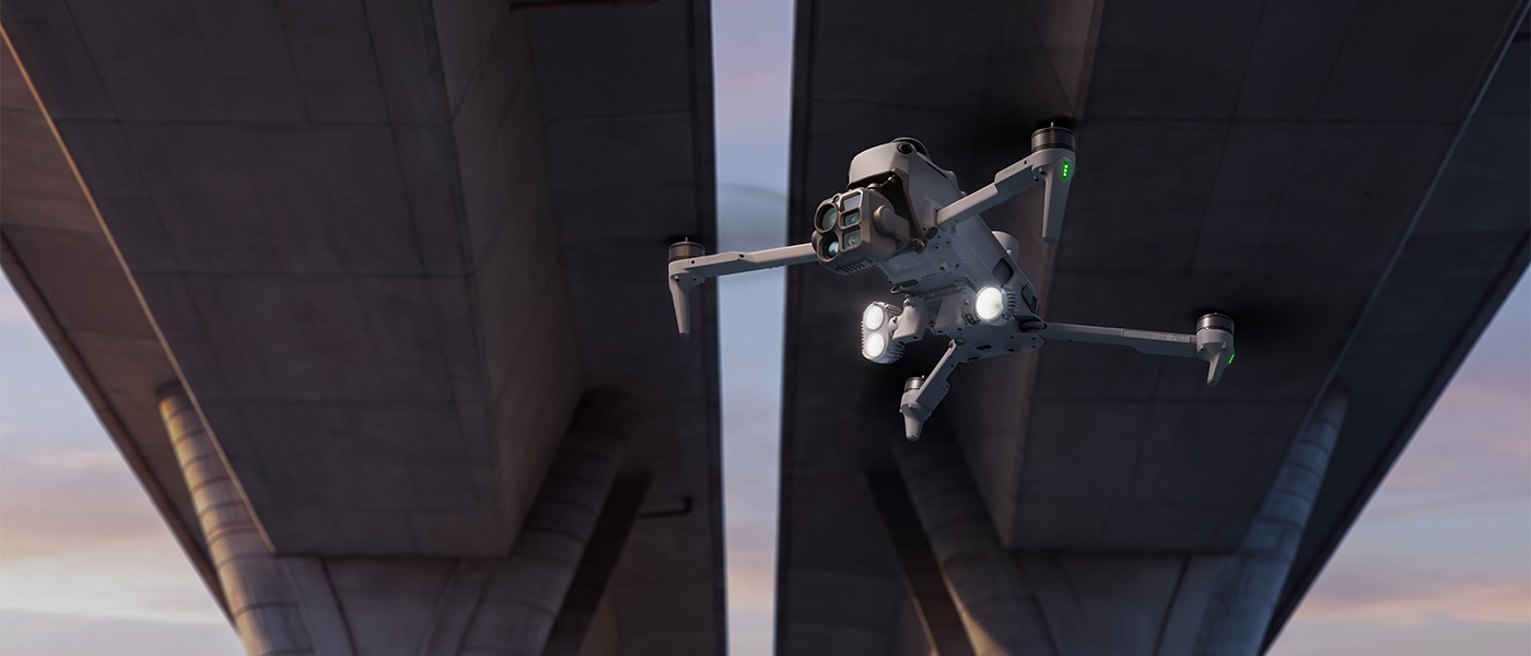
The obstacle sensing system combines 360° scanning LiDAR, mmWave radar facing forward, upward and downward, and omnidirectional vision sensors. These technologies complement one another during daytime and nighttime operations. The manufacturer specifies wire detection at 32 m, while mmWave radar also supports detection in rain, fog and dust.
Flight Assist View provides a colour view of the space around the drone. Split-screen layouts let you monitor both the details of the inspected object and the aircraft’s surroundings. You can choose from up to 11 view layouts, combining camera feeds, thermal imaging, the map and the assist view.
IP55 protection and operation from −20°C to 50°C
DJI Matrice 5T has a sealed, multi-compartment enclosure with an IP55 protection rating and an operating temperature range of −20°C to 50°C. This allows inspections and field operations to be planned in conditions that place greater demands on equipment.
Built-in ADS-B and RID receivers provide alerts about nearby aircraft. The presentation describes the detection of crewed aircraft and nearby DJI drones, helping the operator assess the airspace around the mission area.
Up to 59 minutes of flight – more time to complete the task
The maximum stated flight time is 59 minutes, with up to 54 minutes of hovering. Compared with Matrice 4T, this provides up to 10 extra minutes of flight, which you can use for observation, additional images or inspection of another section of infrastructure.
The drone reaches speeds of up to 23 m/s, ascends at up to 10 m/s and descends at up to 8 m/s. The revised propeller design improves propulsion efficiency and reduces noise. These figures are maximum specifications stated by the manufacturer.
Battery and 515 W charging hub – organise successive flights more efficiently
The intelligent battery stores 215.2 Wh of energy and features self-heating in low temperatures. The 515 W charging hub uses active cooling and charges three batteries sequentially. The manufacturer specifies 30 minutes to charge from 10% to 95%.
Standard mode charges the battery to 100%, while Standby mode charges it to 95%. Using three batteries allows you to rotate them between the drone and the hub; according to the presentation, this enables continuous operations in typical conditions. Matrice 5T does not support hot-swapping batteries while powered on.
4G connectivity and DJI RC Plus 3 Enterprise controller
Matrice 5T has two built-in 4G connectivity modules that automatically select the better network connection. Smart frequency switching supports transmission in areas affected by interference, including among tall buildings. The controller also has a built-in 4G module; a Nano-SIM card is required to use this connectivity.
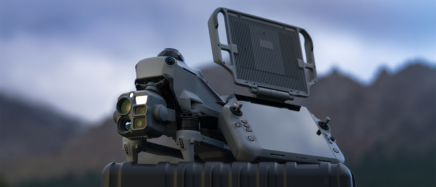
DJI RC Plus 3 Enterprise features a 7.44-inch display with a resolution of 1920 × 1440 and brightness of 2000 nits. The 4T4R High-Gain Smart Array antenna system supports connection stability. The controller has an IP54 protection rating, while HDMI, microSD and Nano-SIM connections help integrate it into the operator’s workstation.
Signal relay in terrain with obstacles
Relay modes let you use an additional drone to forward the signal where terrain makes a direct connection difficult. Configurations support one or two relay hops, with up to three drones and two controllers.
You can control the relay drone and the work drone from a single controller or divide the tasks between operators. According to the manufacturer’s FAQ, relay functionality does not support other models at the launch of Matrice 5T; support is planned for a later update.
More than 20 object types detected by AI
Onboard visible-light image analysis covers more than 20 object types, including people, vehicles, vessels, animals, smoke and fire. The system also recognises clothing colours. This helps you find objects relevant to the observation task more quickly.
Parallel analysis of visible-light and thermal imagery lets you compare information from both sources on a split screen. 10 TOPS of onboard computing power and support for third-party algorithms allow custom AI solutions to be developed for specific tasks.
Automated power line inspection and modelling in the field
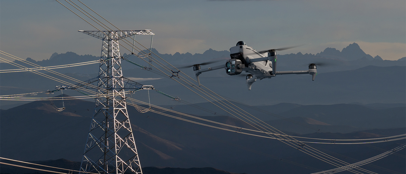
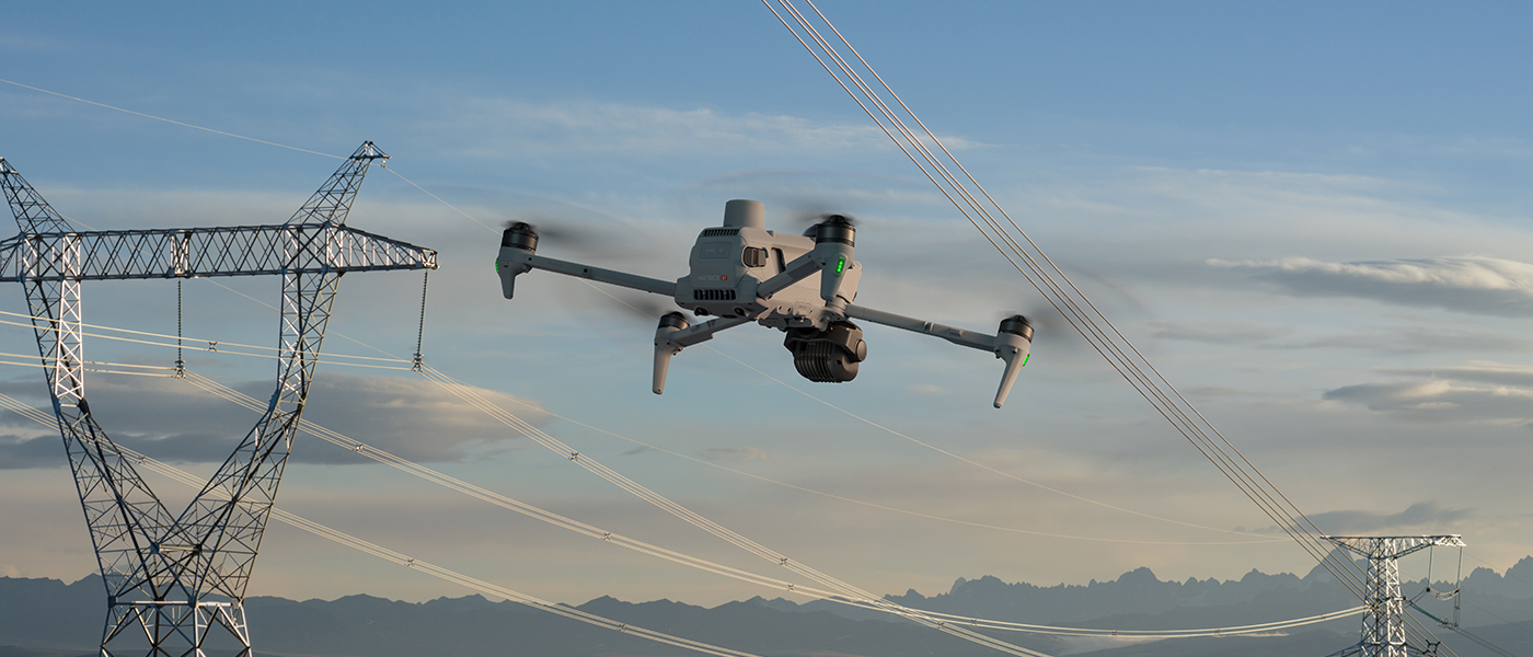
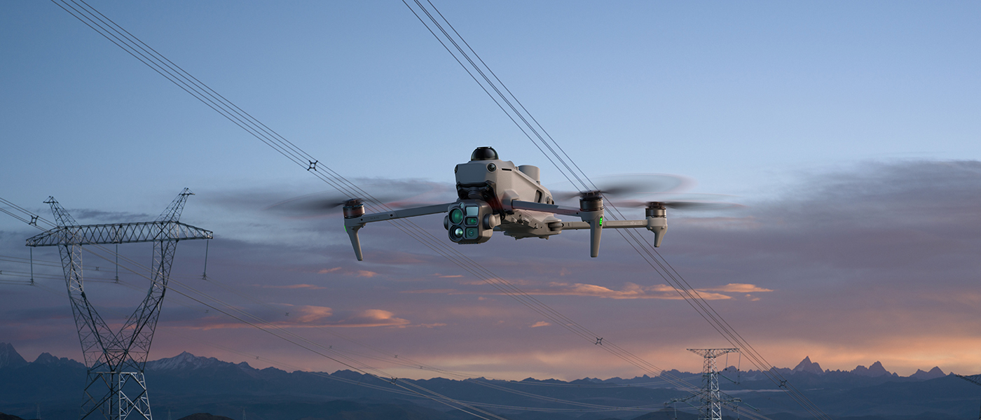
During power infrastructure inspections, the top-mounted LiDAR detects and tracks conductors and ground wires. This enables automatic sideways flight along a line and reduces the workload of manually piloting the drone while searching for damage or foreign objects.
The modelling function creates point clouds and 2.5D models locally. The manufacturer gives an example of producing a map from 200 photos in 8 minutes after image capture. Flight routes and area missions are supported, and each reconstruction should contain fewer than 400 photos.
Takeoff and landing on vessels
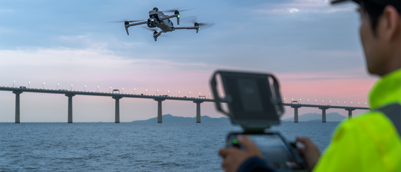
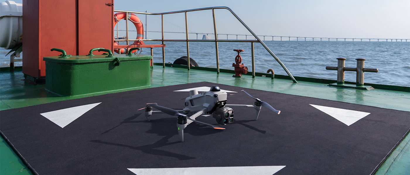
Matrice 5T supports takeoff from vessels and automatic landing on deck markers. This allows patrols and inspections to be carried out without returning the boat to a shore base every time.
The manufacturer recommends using this function at vessel speeds below 10 knots and wind speeds below 5 m/s. A 3 × 3 m area and the same standard landing marker used for DJI Matrice 400 should be provided on deck.
DJI Pilot 2 – tools tailored to your team’s procedures
Support for custom DJI Pilot 2 plugins lets the application be extended with tools for inspection, security, mapping and public safety operations. Developers can use ready-made interface elements such as widgets, dialog boxes, map annotations, AR components, a route library and checklists.
Integration through MSDK provides access to video streaming, multimedia, route management and a virtual joystick, among other functions. This makes it easier to connect specialist software with the drone’s capabilities and the team’s workflow.
DJI Care Enterprise Plus – one year of service coverage
According to the supplied materials, DJI Matrice 5T includes a complimentary one-year DJI Care Enterprise Plus plan starting at activation. Within the allocated coverage limit, the service covers repairs for damage, including water damage, and shipping to and from the service centre.
If the drone is lost during flight, the Flyaway programme offers a replacement for a fee. Coverage can be renewed up to the fifth year, with renewals for years four and five subject to additional DJI review. Renewal conditions depend on factors including spare parts availability and the equipment support period.
Included equipment and optional accessories
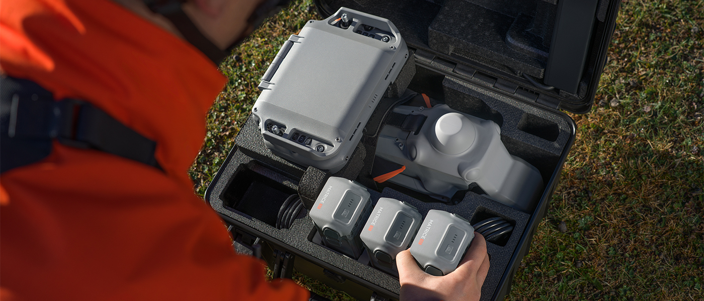
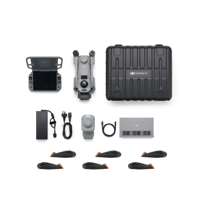
The equipment list includes the drone, DJI RC Plus 3 Enterprise controller, charging hub, three pairs of propellers, charger with power cable, USB-C to USB-C cable, gimbal protector and carrying case. The presentation lists the battery as sold separately.
The optional DJI AS2 speaker rated at 35 W broadcasts messages over distances of up to 400 m, including live announcements and text-to-speech. The DJI AL2 spotlight rated at 60 W offers spotlight and floodlight modes; in floodlight mode, the manufacturer specifies an illuminated area of up to 1500 m² from a height of 100 m. Both accessories can be installed at the same time. Optional anti-icing propellers are also available.
Frequently asked questions – DJI Matrice 5T
What tasks is DJI Matrice 5T designed for?
- Matrice 5T is designed for search and rescue, public safety operations, power infrastructure inspections, and terrain mapping and modelling.
What is the resolution of the DJI Matrice 5T thermal camera?
- The native resolution is 1280 × 1024, providing four times as many pixels as Matrice 4T. The camera offers digital zoom up to 32× and Fusion mode, which combines thermal and visible-light imagery.
What is the maximum flight time of DJI Matrice 5T?
- The manufacturer specifies up to 59 minutes of flight and up to 54 minutes of hovering. These are maximum figures stated in the product materials.
Can DJI Matrice 5T be used for nighttime observation?
- Yes. The three visible-light cameras support colour night vision. The telephoto camera also offers a monochrome mode and works with the NIR auxiliary light, with a range of up to 100 m at zoom levels of 11× and above. A thermal camera is also available.
How does DJI Matrice 5T detect obstacles?
- The drone combines 360° scanning LiDAR, mmWave radar and omnidirectional vision sensors. The manufacturer specifies wire detection at 32 m. Colour Flight Assist View helps you monitor the surroundings during flight.
What temperatures can DJI Matrice 5T operate in?
- The drone’s operating temperature range is −20°C to 50°C, and its enclosure has an IP55 protection rating. The DJI RC Plus 3 Enterprise controller is rated IP54.
Is a battery included, and can it be replaced without turning off the drone?
- The presentation’s SKU list marks the battery as sold separately. Matrice 5T does not support hot-swapping batteries while powered on. The 515 W hub charges three batteries sequentially; the stated charging time from 10% to 95% is 30 minutes.
Does DJI Matrice 5T have built-in 4G connectivity?
- Yes. The drone has two built-in 4G modules, and the controller has one. A Nano-SIM card is required to use this connectivity.
Are the AS2 speaker and AL2 spotlight also compatible with Matrice 5TD?
- No. The manufacturer’s FAQ states that DJI AS2 and DJI AL2 accessories for Matrice 5T are not compatible with Matrice 5TD, which is designed for DJI Dock 4.
Specification DJI Matrice 5T Drone
Brand
DJI
Symbol
CP.EN.00000828.01
Producer code
6937224183049
Series
DJI Enterprise
Warranty
24 months
Model
DJI Matrice 5T
Weight
Masa startowa ze śmigłami: 2239 g; obejmuje akumulator i kartę microSD. Rzeczywista masa może różnić się zależnie od partii i czynników zewnętrznych.
Maks. masa startowa
2639 g
Dimensions
Po rozłożeniu: 408 × 507 × 191 mm (dł. × szer. × wys.), z podwoziem i gimbalem, bez śmigieł.
Po złożeniu: 335 × 155 × 203 mm (dł. × szer. × wys.), z podwoziem i gimbalem, bez śmigieł.
Maks. udźwig
400 g
Rozmiar śmigieł
14,2 cala; model śmigieł 1460F; rozstaw osi po przekątnej 572 mm.
Climbing speed max.
10 m/s; również z głośnikiem DJI AS2 i reflektorem DJI AL2.
Descent speed max.
8 m/s; również z głośnikiem DJI AS2 i reflektorem DJI AL2.
Maks. horizontal speed (close to sea level, no wind)
Do 23 m/s do przodu, 19 m/s bokiem i 20 m/s do tyłu (tryb Sport). Pomiar w tunelu aerodynamicznym w warunkach odpowiadających brakowi wiatru na poziomie morza.
Maks. wysokość startu
7000 m; maksymalna wysokość pracy z akcesoriami DJI AS2 i DJI AL2: 4500 m.
Maks. flight time
59 min; wynik w tunelu aerodynamicznym, w warunkach odpowiadających brakowi wiatru na poziomie morza, przy locie do przodu około 9 m/s bez dodatkowego wyposażenia, do 0% baterii. Czas zależy od warunków, trybu i akcesoriów. Przestrzegaj komunikatów aplika
Maks. hover time
54 min; pomiar w tunelu aerodynamicznym, w warunkach odpowiadających brakowi wiatru na poziomie morza, bez dodatkowego wyposażenia, do 0% baterii. Wynik orientacyjny, zależny od trybu, akcesoriów i otoczenia. Przestrzegaj komunikatów aplikacji.
Maks. takeoff height
45 km; pomiar w tunelu aerodynamicznym, w warunkach odpowiadających brakowi wiatru na poziomie morza, przy locie do przodu około 15 m/s bez dodatkowego wyposażenia, do 0% baterii. Wynik orientacyjny, zależny od trybu, akcesoriów i otoczenia. Przestrzegaj
Maks. wind resistance
12 m/s podczas startu i lądowania.
Maks. angular velocity
32°
Operating temperature
Od −20°C do 50°C, bez promieniowania słonecznego.
Satellite navigation system
GPS + Galileo + BeiDou + GLONASS + QZSS
Hovering precision range
Pionowo: ±0,1 m przy pozycjonowaniu wizyjnym; ±0,5 m przy GNSS; ±0,1 m przy RTK.
Poziomo: ±0,3 m przy pozycjonowaniu wizyjnym; ±0,5 m przy GNSS; ±0,1 m przy RTK. W warunkach bezwietrznych lub przy lekkim wietrze.
Dokładność GNSS RTK
RTK FIX: 1 cm + 1 ppm w poziomie; 1,5 cm + 1 ppm w pionie.
Porty
3 × E-Port; obsługa oficjalnych akcesoriów DJI i wyposażenia innych producentów.
Światło sygnalizacyjne
Wbudowane w drona.
IP degree of protection
IP55; stopień ochrony nie jest trwały i może obniżać się wskutek normalnego zużycia. Przestrzegaj instrukcji ochrony IP55.
Matrix
Kamera szerokokątna: CMOS 1/0,98 cala, 50 MP.
Kamera ze średnim teleobiektywem: CMOS 1/1,28 cala, 50 MP.
Telekamera: CMOS 1/1,5 cala, 50 MP.
Lens
Kamera szerokokątna: DFOV 85,7°; ekwiwalent ogniskowej 23,5 mm; f/1,8; ostrość od 0,6 m do ∞.
Średni teleobiektyw: DFOV 35°; ekwiwalent ogniskowej 70 mm; f/2,88; ostrość od 3 m do ∞.
Telekamera: DFOV 9,7°; ekwiwalent ogniskowej 252 mm; f/2,8; ostrość od 5 m do ∞.
Zasięg ISO
Tryb standardowy: ISO 100–25 600.
Tryb nocny: kamera szerokokątna, średni teleobiektyw i telekamera: ISO 100–1 638 400.
Czas otwarcia migawki
Od 2 s do 1/8000 s.
Maks. image size
Kamera szerokokątna, średni teleobiektyw i telekamera: 8192 × 6144.
Photography modes
Wszystkie trzy kamery: zdjęcia pojedyncze i interwałowe 12 MP/50 MP; JPEG co 0,5/0,7/1/2/3/5/7/10/15/20/30/60 s; inteligentne fotografowanie 12 MP.
Kamera szerokokątna: panorama 12 MP (zdjęcie źródłowe), 110 MP (obraz połączony).
Photo format
JPEG/DNG (RAW)
Video resolution
4K: 3840 × 2160 przy 30 kl./s; FHD: 1920 × 1080 przy 30 kl./s. Kodek H.265, bitrate CBR lub VBR.
Maksymalna szybkość transmisji wideo
H.265: 40 Mb/s
Video format
MP4, TS; obsługiwany system plików exFAT.
Digital zoom
Telekamera: 16×; zoom hybrydowy do 176×.
Kamera termowizyjna
Niechłodzony detektor VOx; natywna rozdzielczość 1280 × 1024; rozmiar piksela 8 μm; 30 Hz. NETD ≤50 mK przy f/1,0 i temperaturze otoczenia 25°C.
Obiektyw: DFOV 45°; ekwiwalent 53 mm; f/0,85; ostrość od 10 m do ∞. Zoom cyfrowy 32×; pasmo 8–14 μm.
Pomiar punktowy i obszarowy. High Gain: od −20°C do 150°C, dokładność ±2°C lub ±2% (większa wartość). Low Gain: od 0°C do 550°C, dokładność ±5°C lub ±3% (większa wartość).
Zdjęcia: 1280 × 1024; 2560 × 2048 z włączonym UHR. Format JPEG (8-bit), R-JPEG (16-bit), DLT-664. JPEG co 0,5/0,7/1/2/3/5/7/10/15/20/30/60 s.
Wideo MP4: 1280 × 1024 przy 30 kl./s (H.265, 12 Mb/s); 2560 × 2048 przy 30 kl./s z UHR (H.265, 24 Mb/s).
Palety: White Hot, Black Hot, Tint, Iron Red, Hot Iron, Arctic, Medical, Fulgurite, Rainbow 1, Rainbow 2.
Nie kieruj kamery termowizyjnej na słońce, lawę lub wiązkę lasera — grozi to trwałym uszkodzeniem sensora.
Dalmierz laserowy
Zasięg 3000 m (1 Hz, współczynnik odbicia 25%, widoczność 8 km); przy padaniu ukośnym 1200 m (nachylenie 1:10, 1 Hz, współczynnik odbicia 25%, widoczność 8 km). Martwa strefa 1 m.
Dokładność (1–10 Hz, współczynnik odbicia 20–90%): błąd systematyczny <0,1 m przy 1–12 m; <0,3 m przy 12–100 m; <1 m przy 100–3000 m. Błąd losowy <0,1 m (1σ). Laser klasy 1 (IEC 60825-1:2014), bezpieczny dla oczu.
Oświetlenie podczerwone
Oświetlacz NIR: FOV od 5,2° do 6,6°.
Stabilization
3-osiowa: pochylenie, przechylenie i panoramowanie.
Mechanical range
Gimbal: pochylenie od −145° do 125°; przechylenie od −53° do 53°; panoramowanie od −75° do 75°.
Ograniczenia programowe: pochylenie od −135° do 115°; przechylenie od −48° do 48°; panoramowanie od −60° do 60°.
Control range
Gimbal: pochylenie od −90° do 90°; maksymalna prędkość pochylenia 100°/s. Panoramowanie niedostępne z kontrolera; sterowanie możliwe przez MSDK.
Angular vibration range
±0,007°
Type of sensors
Sześciokierunkowy system wizyjny typu rybie oko: 4 kamery skierowane w górę i 2 w dół; poziomy obrotowy LiDAR; radar mmWave do przodu, w górę i w dół; dolny czujnik ToF.
System wykrywania przeszkód
Przód: system wizyjny — pomiar 0,15–12 m, wykrywanie 0,15–200 m, FOV 90° w poziomie i 130° w pionie; LiDAR 0,5–32 m, FOV 90° w poziomie i 59° w pionie; radar — małe przeszkody do 40 m, FOV 90° w poziomie i pionie. Skuteczna prędkość ≤21 m/s.
Tył: pomiar wizyjny 0,15–12 m, wykrywanie 0,15–200 m, FOV 90° w poziomie i 126° w pionie; LiDAR 0,5–32 m, FOV 90° w poziomie i 59° w pionie; skuteczna prędkość ≤21 m/s.
Boki: pomiar wizyjny 0,18–8 m, wykrywanie 0,18–200 m, FOV 90° w poziomie i pionie; LiDAR 0,5–32 m, FOV 90° w poziomie i 59° w pionie; skuteczna prędkość ≤21 m/s.
Góra: radar — małe przeszkody do 20 m, FOV 90° przód/tył i lewo/prawo; skuteczna prędkość ≤10 m/s.
Dół: pomiar wizyjny 0,13–8 m, wykrywanie 0,25–200 m, FOV 150° przód/tył i lewo/prawo; radar — małe przeszkody do 20 m, FOV 90° przód/tył i lewo/prawo; skuteczna prędkość ≤8 m/s.
Podane zasięgi radaru dla małych przeszkód dotyczą czarnego izolowanego przewodu 10 mm na wprost. Radar może być ograniczony lub niedostępny regionalnie.
Obrotowy LiDAR: 110 m przy współczynniku odbicia 10% i 100 000 lx; FOV 360° w poziomie i 59° w pionie; 250 000–460 000 punktów/s; 940 nm; klasa lasera 1 (IEC60825-1:2014).
LiDAR — przewody: 32 m dla przewodu aluminiowego ze stalowym rdzeniem 21,6 mm; 19 m dla zabrudzonego izolowanego przewodu 11,0 mm. Warunki: 35 000 lx, względne przechylenie kadłuba 30° w lewo i prawo.
Wymagane powierzchnie o wyraźnej fakturze i odpowiednie oświetlenie; dla dołu także odbicie rozproszone i współczynnik odbicia >20%. Dostateczne oświetlenie oznacza natężenie nie niższe niż w nocnej scenie oświetlonego miasta.
Video transmission system
DJI O4 Enterprise Enhanced Video Transmission System
Dwa wbudowane moduły DJI Cellular Dongle 2; obsługa dwóch kart SIM: jednej eSIM i jednej fizycznej nano-SIM.
Live view quality
Kontroler: 3 kanały 1080p przy 30 kl./s.
Operational frequency
902–928 MHz; 1,430–1,444 GHz; 2,400–2,4835 GHz; 5,725–5,850 GHz; 5,150–5,250 GHz. Dozwolone pasma zależą od kraju i regionu.
Moc nadajnika (EIRP)
902–928 MHz: <30 dBm (IC), <16 dBm (MIC).
1,430–1,444 GHz: <35 dBm (SRRC).
2,400–2,4835 GHz: <33 dBm (IC), <20 dBm (CE/SRRC/MIC).
5,150–5,250 GHz: <23 dBm (IC/CE).
5,725–5,850 GHz: <33 dBm (IC), <14 dBm (CE), <30 dBm (SRRC). Dostępność pasm zależy od kraju i regionu.
Maks. transmission distance
40 km (IC); 20 km (CE/SRRC/MIC). Pomiar bez przeszkód i zakłóceń, dla lotu w jedną stronę bez powrotu. Przestrzegaj przypomnień RTH w DJI Pilot 2.
Maks. transmission distance (with interference)
Silne zakłócenia: około 1,5–6 km (IC), 0,7–3 km (CE).
Średnie zakłócenia: około 6–15 km (IC), 3–7 km (CE).
Słabe zakłócenia: około 15–40 km (IC), 7–20 km (CE). Pomiar bez przeszkód, przy typowych zakłóceniach. Dane orientacyjne, bez gwarancji rzeczywistego dystansu.
Maks. download speed
Tryb standardowy: 20 MB/s dla multimediów i logów drona; pobieranie w trybie odtwarzania <12 Mb/s; bitrate pojedynczego kanału ≤12 Mb/s. Pomiar przy małej odległości drona od kontrolera, bez zakłóceń.
Delays (depending on ambient conditions and mobile device)
130 ms; pomiar z małej odległości, bez zakłóceń, przy kamerze 1×. Opóźnienie zależy od otoczenia i urządzenia mobilnego.
Antenna
Dron: 6 anten SDR — 2 pionowe i 4 poziome; 2 pionowe anteny Sub2G; 4 anteny 4G, tryb 2T4R; 1 pionowa antena Wi-Fi.
Supported memory cards
U3/Class10/V30 lub wyższa albo karta z listy zalecanej.
Zalecane: Lexar Professional SILVER PLUS 64/128/256/512 GB U3 A2 V30 microSDXC.
Accumulator
Pojemność 10 073 mAh; napięcie nominalne 21,36 V; maksymalne napięcie ładowania 25,8 V; Li-ion 6S; energia 215,2 Wh; masa 768 g.
Temperatura ładowania od 5°C do 40°C; współczynnik rozładowania 4C; maksymalny współczynnik ładowania 1,8C; samonagrzewanie przy ładowaniu w niskiej temperaturze; 200 cykli.
Method of charging
Hub 515 W: sekwencyjne ładowanie trzech akumulatorów DJI Matrice 5 Series Battery; Standard 100% SOC; Standby 95% SOC; temperatura ładowania od 5°C do 40°C.
Hub: wejście 14,9–26,4 V, maks. 22 A; wyjście akumulatora 15–25,8 V; USB-C 5/9/12/15/20/28 V.
Zasilacz 515 W: wejście 100–240 V AC, 47–63 Hz, maks. 7 A; wyjście 14,9–26,4 V, maks. 22 A.
Controller
DJI RC Plus 3 Enterprise, model TKPL 3; ekran 7,44 cala, 1920 × 1440, 60 Hz, 2000 nitów, dotyk 10-punktowy.
Wbudowany akumulator 6933 mAh (99,01 Wh); masa 1240 g; wymiary 225 × 156 × 85 mm przy złożonym panelu antenowym; stopień ochrony IP54, który może obniżać się wskutek zużycia.
Inteligentny układ antenowy o wysokim zysku 4T4R; transmisja 902–928 MHz, 2,400–2,4835 GHz, 5,150–5,250 GHz i 5,725–5,850 GHz, zależnie od przepisów regionalnych.
Wi-Fi Direct, Wireless Display, IEEE 802.11a/b/g/n/ac/ax, 2 × 2 MIMO; pasma 2,400–2,4835 GHz, 5,150–5,250 GHz i 5,725–5,850 GHz. Pasma 5,8 i 5,2 GHz mogą być zabronione; 5,2 GHz bywa ograniczone do wnętrz.
Bluetooth 5.4, 2,400–2,4835 GHz, EIRP <10 dBm; GNSS GPS + Galileo + BeiDou + GLONASS; macierz mikrofonów; Android 16.
Złącza: HDMI 1.4, SD 3.0, gniazdo nano-SIM, USB-C i E-Port.
Entity responsible for this product in the EU
DJI Europe B.V.More
ProducerDJI Europe B.V.Address:
Bijdorp-Oost 6Postal code: 2992City: BarendrechtCountry: NetherlandsE-mail: dealer.nl@dji.com
Responsible entityDJI Europe B.V.Address:
Bijdorp-Oost 6Postal code: 2992City: BarendrechtCountry: NetherlandsPhone number: 180745733E-mail: dealer.nl@dji.com
 Get expert advice
Ask a question
Add an opinion